


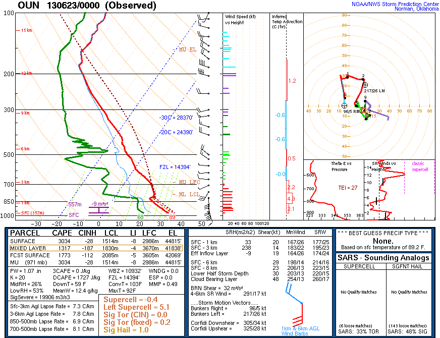
ELECTRIC THUNDERSTORMS & TORNADOES 1
The Electromagnetic Nature of Tornadic Supercell Thunderstorms

The Electromagnetic Nature of Tornadic Supercell Thunderstorms - Part 1
Last modified: 2016-08-01 06:45:09 UTC
© 2007~2024 Charles L. Chandler geophysics@charles-chandler.org
Comments, criticisms, and suggestions may be posted on the associated bulletin board.
Contents {Part 1}
People who have read previous versions of this work might be surprised to see that the contentions herein continue to evolve. Unlike academic works, which are permanent records of opinions as they were at the time, and to which scholars become attached for the sake of credibility, this is a dynamic work, continually pursuing a more accurate description of the topic. Hence this work has changed, as comments and criticisms from readers like you have created opportunities for improvements, and it will continue to change. This causes confusion, but that's better than tenacity in the face of legitimate criticisms. Perhaps this will always be a work-in-progress, as it is doubtful that any of us will live to see something as complex as a tornadic supercell completely described. But if we should ever have to choose between truth and credibility, we must always choose truth, because credibility isn't worth much without it. And while the work that remains to be done dwarfs what is already here, it is nevertheless arguable that this has emerged as the most complete theory of tornadic storms ever presented to the public. So the open-minded, evolutionary method is working, and therefore, it will persist.
Also, please note that in meteorology, the term "thermodynamics" is used in the narrowest of its senses: the dynamics of thermal fluxes. It is also assumed that the topic is open-air convective systems. Within this context, thermodynamics is the study of heat sources and sinks that alter the density of the air, which in the presence of gravity results in airflows, which can be quantified in fluid dynamic terms. Other disciplines use "thermodynamics" to refer to general principles of energy and entropy that apply to all forces, including electromagnetism. But in meteorology, electromagnetism and thermodynamics are studied separately. For example, the following is a quote from an FAQ page maintained by NSSL.
Question: Are there electromagnetic or magnetohydrodynamic explanations for the development of tornadoes?
Answer: As far as scientists understand, tornadoes are formed and sustained by a purely thermodynamic process.
The present work takes a very different position, and demonstrates that electromagnetism has to be promoted to the status of a peer with thermodynamics if we are to achieve a more accurate description of the phenomena. But the point here is that the reader may find it odd to hear electromagnetism and thermodynamics being discussed as peers — that's not the correct relationship between these two sets of principles. Yet in meteorology, this is conventional usage of the terms.
Supercell thunderstorms, and the tornadoes they spawn, are considered. Consistency with the current research trends within the disciplines of meteorology and geophysics is neglected in the pursuit of a mechanistic model that can more accurately describe the distinctive characteristics of tornadic supercells. Specifically, the common assumption that electromagnetism is too weak to influence the behavior of a supercell is challenged. The charge separation process in the storm creates electric fields that exert a force more powerful than gravity on charged particles, which then exert aerodynamic forces on the surrounding air, thereby modulating the flow fields. Charged gases also have lower viscosities, and therefore flow faster in pressure gradients. Furthermore, charged gases are less prone to turbulence, with dramatic effects on the net velocities. Studying supercells as charged gases might enable solutions to many otherwise intractable problems. Most significantly, a mechanistic model of the tornadic flow field is presented. While a tornado occurs within the influence of a low pressure aloft, and is typically thought to be a simple suction vortex, its defining characteristics are that the lowest pressure, tightest radius, and fastest wind speeds occur at the ground, farthest from the low pressure aloft, and where the friction is the greatest. This proves that the primary energy conversion occurs at the ground, and that the low pressure aloft is merely absorbing the exhaust from that conversion. In conventional meteorology, the only energy available for conversion near the ground is latent heat stored in water vapor, but the release of latent heat continues through the entire height of the tornado (and beyond), and therefore cannot be concentrated just at the base of the vortex. The only other force present is electromagnetism. Previous research showed that ohmic heating from the flow of an electric current through the tornado is more powerful than latent heating, but similarly, this energy is thermalized through the entire height of the vortex, leaving the extreme low pressure near the ground unexplained. The sustained current inside the tornado was confirmed by various methods to be greater than 100 amps. Inexplicably, evidence of such a current going into the ground has never been found. The possibility not considered by previous research is that the current terminates in the air itself, meaning that the tornadic inflow is charged. If so, it induces an opposite charge in the ground, and is attracted to that charge. As the air flows along the ground, skin friction generates heat. Once the air enters the vortex, the electric current neutralizes the charge, releasing the air from its attraction to the ground, and thus releasing all of the accumulated thermal potential. This means that the unexplained power expended by the tornado on the ground answers its own question, as the frictional heat so generated is the only energy that could cause a robust updraft so close to the ground, while the charge neutralization is the critical conversion. The energy budget of the entire tornado can then be reconciled as the sum of frictional heating at the ground, latent and ohmic heating inside the vortex, and the low pressure aloft. An extensive review of the available data is made, without finding reason to abandon this model. The implications are then considered.
Figure 1. Conceptual model of the movement of charged particles in a symmetrical tornadic storm (such as a "pulse" storm). Asymmetrical storms, in which wind shear is a big factor, will be treated as variations on the same principles.

Every year in the U.S., on average, tornadoes destroy $982 million worth of property,1,2 and kill 89 people.3 (Note that average damage estimates vary widely, from one year to the next, and depending on the source of the report. FEMA reports average losses of roughly $500 million, but that's just what it pays.2 Insurance companies reported losses were roughly $27 billion in 2011 and $15 billion in 2012 — the two costliest years on record.4 The total, including uninsured losses, is obviously far greater.)
There is no known way to prevent tornadoes, so there is no way to avoid damage to permanent structures. The only defensive strategy against tornadoes involves teaching people how to respond in the event of a tornado, and issuing warnings when tornadoes are approaching.
There are three types of tornado forecasts issued by the U.S. National Weather Service (NWS).
Convective outlooks are issued up to 3 days in advance, and discuss the probability of tornadoes on a regional basis. These typically cover substantial portions of states, or several states, and are not specific enough to warrant defensive measures on the part of the general public. Outlooks are used to modulate NWS resource allocation, such that critical conditions are well-monitored.
Tornado watches are issued several hours in advance, and though more specific than convective outlooks, are still essentially regional advisories, typically covering over 50,000 km2. While convective outlooks are projections of probabilistic factors, tornado watches are based on the actual conditions that develop during the day. The main intent of tornado watches is to give emergency managers time to prepare for what might happen.
Tornado warnings are issued when Doppler radar detects mesocyclonic rotation at speeds characteristic of an actively tornadic supercell. Frequently, storm spotters confirm that the tornado warning was issued just as the funnel cloud began to descend. In short, a tornado warning means that a tornado is currently forming, and will be on the ground in a matter of minutes. These are specific enough to warrant defensive measures on the part of the general public.
In October of 2007, NWS transitioned from county-wide warnings to "storm-based" warnings. The warning zones are far smaller, and this has resulted in a vast reduction in the number of people getting warned unnecessarily.
Figure 2. Storm-based warnings, courtesy NWS.

But despite the advances that have been made, the science behind tornado warnings is far from mature. The following statistics are from the NOAA 2011 Budget (beginning on pg. xlviii), and show the lead time, accuracy, and false alarm rate of tornado warnings, 2006~2011.
Table 1. Severe Weather Warnings: Tornadoes (storm-based)

The lead time could be increased, and the number of unwarned events could be reduced, by lowering the threshold for what is considered to be sufficient mesocyclonic rotation for tornadogenesis. But this would increase the false alarm rate, and that would lower the credibility of the information being disseminated. All factors considered, the existing criteria for issuing tornado warnings are striking the right balance.5
But with only 13 minutes of lead time, people in harm's way do not have very many options. Seeking shelter in a better-built structure nearby is risky, and evacuating is out of the question. (An unfortunate percentage of people killed by tornadoes die in their cars as they attempt to outrun the storms, not realizing that poor visibility, downed trees and power lines, and other motorists can block their way, leaving them totally exposed to the tornado.)
And there is another vital bit of information that is not even present in the tornado warnings, because we simply do not have this information in advance: an estimate of how powerful the tornado will become. Most tornadoes are weak, and these are responsible for a very small percentage of the tornado-related deaths. If the false alarm rate included all of the warnings for weak tornadoes that posed little danger to the public, the false alarm rate would be far higher.
Figure 3. Tornado statistics by F-Scale, 1950~1994, from The Tornado Project.

Improvements in the lead time, and in the reliability of the warnings, including gaining the ability to predict the strength of the tornado that will form, will have tangible benefits.6 One study cited lost time due to false alarms as the biggest expense of tornadoes.5 More reliable warnings would also be taken more seriously, and people would take the appropriate actions, instead of ignoring the warnings.5 And the greater the lead time, the more things that can be done to save lives, and even certain types of property. The following is a rough representation of the kinds of defensive measures can be taken, given the amount of lead time, and assuming that the warnings are reliable enough to warrant such measures.
10 minutes — people can go to the lowest level in the building, and get under something sturdy. This is the extent of the current defensive strategy.
20 minutes — people could run to nearby structures that offer better protection, and people in cars could find suitable shelter. Parked cars could be moved into garages.
30 minutes — airports could get planes into the air to avoid being destroyed. (See this for photos of Tinker Air Force Base after getting hit by a tornado on March 20, 1948. A week later another tornado hit the same base, but meteorologists predicted it, and many planes were moved into hangers, greatly reducing the destruction.)
1 hour — people in rural areas could get into cars and get out of the way of the tornado. Schools and businesses could be closed, and sports arenas could be evacuated.
2 hours — small population centers could be evacuated.
Obviously, the longer the lead time, the less reliable the forecast, and the more questionable it becomes to consider large-scale defensive measures. But we should not rule out the possibility that even longer lead times than this might be possible someday. Furthermore, we should acknowledge that not all decisions are made in exactly the same way, and require exactly the same degree of certainty. There have been cases in which the convective outlook was so convincing that schools were closed for the day, and many lives were saved, even though the conditions had not yet materialized for tornado watches, much less for tornado warnings.7 Every advance in our understanding of tornadic storms has led, and will continue to lead, to more lives saved and more property protected.
And while the science of tornadoes is advancing, everybody agrees that it isn't advancing fast enough. As our cities and suburbs continue to grow, the cost of storm-scale catastrophes increases.8 Because of this, aggressive initiatives are being considered for mitigating the risks posed by tornadoes. Included are plans for the implementation of finer-resolution Doppler radar,9 and/or many more Doppler radar installations,10,11 both of which will improve the quality of tornado warnings. There has even been funded research concerning the disruption of tornadic storms using microwave energy beamed down from a satellite,12,13,14,15,16,17 or by triggering lightning strikes,18,19,20 thereby eliminating the death and destruction that tornadoes cause.
But these are all brute-force methods, assuming that we already understand the adversary, and that we simply have to be more aggressive if we are to make progress. Yet the best-spent money is well-informed money. Seeking a better understanding of these storms must be part of the initiative, and that is where we have the greatest opportunity for progress.
Figure 4. Damage from an F4 tornado in La Plata, MD, 2002-04-28, courtesy NOAA.
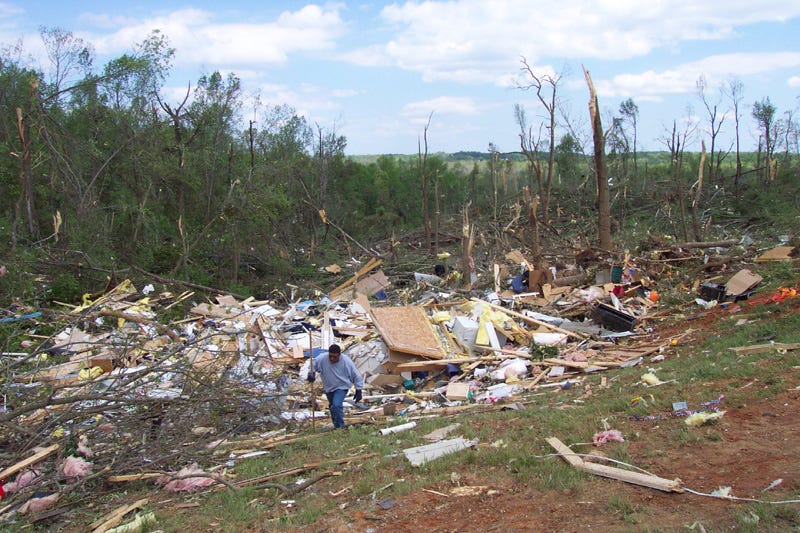
Figure 5. Damage from an F5 tornado in Bridge Creek, OK, 1999-05-03, courtesy NOVA.
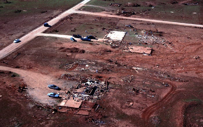
Figure 6. Damage from an EF5 tornado in Greensburg, KS, 2007-05-04, courtesy FEMA.
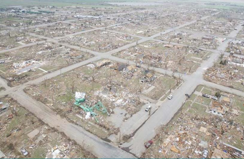
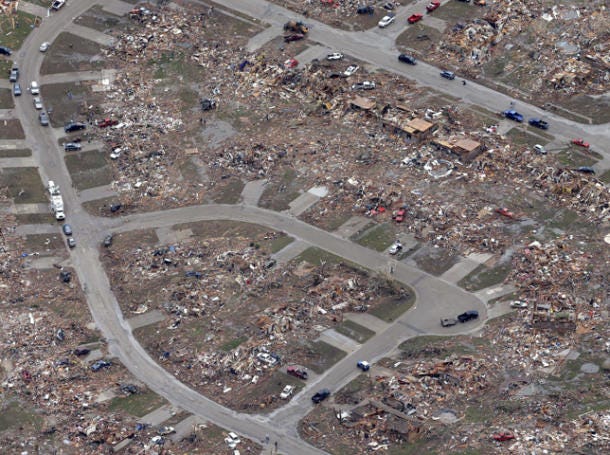
Figure 7. Damage from EF5 tornado in Moore, OK, 2013-05-21, courtesy AP/Tony Gutierrez.
A study of tornadoes begins with a study of the parent thunderstorms. Current research focuses on the thermodynamic factors. The most thorough attempts at modeling the dynamics of thunderstorms have taken the following factors into account:
differences in air temperature, pressure, and humidity at various altitudes in the troposphere before the storm begins,
heat sources and sinks, including the Sun heating the surface of the Earth, as well as heat exchanges due to the evaporation and condensation of water molecules,
the motion of parcels of air due to changes in density, given the force of gravity, and given the density of neighboring parcels,
where and when the water molecules will change state within the cloud,
the effect of gravity on liquid and solid water particles, and
the aerodynamic effect that liquid and solid water particles will have on the parcels of air through which they fall.
That's all of the forces operative at this scale, except electromagnetism. Unfortunately, physics simulations incorporating just these factors fail to resolve into supercells. And while probabilistic modeling based on thermodynamics can predict the emergence of supercells far better than chance, researchers are baffled by the cases in which all of the known factors were present, and yet no supercell formed. This suggests that we're missing something, and of course, the only thing that we're not taking into account is electromagnetism.
The omission of electromagnetism is not because anybody doubts its presence in thunderstorms. Rather, it is omitted because no one has demonstrated that it is anything more than a side-effect. The heat generated by lightning is less than 1% of the total thermal energy in a thunderstorm. This seems to prove that electrification can be safely neglected in the thermodynamic study of thunderstorms.
But this assumes that the only way that electromagnetism could influence a thermal system would be with heat, and that might not be correct.
Lightning results from charge separations that build up due to rapid air motion within the storm. If the electrostatic potential exceeds the resistance of the air, an arc discharge occurs. But at potentials below the threshold for lightning, the electric force is still there, and even over a distance of several kilometers, it can exert a force more powerful than gravity on charged particles.21,22 And the acceleration of charged particles in the air exerts an aerodynamic force that encourages the rest of the air to travel in the same direction. In this way, electromagnetism could influence the behavior of the storm, without generating any heat.
How powerful could this effect be?
While the charge separation process is not fully understood, the part of it that has been the best studied is the electric charges developed in water molecules. At 100% relative humidity, water vapor constitutes only 1% of the air by volume. If the electromagnetic energy in a thunderstorm is only 1% of the total energy, and if that energy can only act on 1% of the particles in the air, the kinetic energy generated by electromagnetism is nominally no more than .01% of the total energy in the storm. And considering the fact that accelerating air by accelerating some of the particles in it is a very lossy energy conversion, we should be surprised if the effect of electromagnetism on the rest of the air was as much as .001% of the total force. In other words, it might as well not be there.
But that analysis is far from correct.
The total amount of EM energy that could be influencing airflows in the storm cannot be gauged by the energy released by lightning, since it is the energy that does not get released by lightning that is capable of actually moving air. If the potential exceeds the resistance of the air, the charge separation is neutralized. At lesser potentials, the airflows are still being influenced. And while instinctively we might think that lesser potentials will have even less effect on the storm, the actual amount of electromagnetic force that does not get discharged in lightning is far larger than the force that does, by definition. If electromagnetism was like water, the resistance of the air would be like a dam, and lightning would be the amount of water that leaked through the dam. If we want to know the total force on the dam (i.e., the aerodynamic force on the surrounding air), the amount of water that got through the dam (i.e., the lightning) is irrelevant, or even inversely related. Either way, it is far less than the total.
Furthermore, water molecules are not the only molecules capable of becoming charged in the atmosphere — they are just the ones that have been studied the most. Nitrogen (N2) and oxygen (O2, O3) are as easily ionized as water molecules, at roughly 14 eV.23,24 In the gaseous state, nitrogen and oxygen do not typically host net negative charges, but all matter can become positively charged. So in the positive charge regions of the storm, we can expect net charges to spread freely into the surrounding nitrogen and oxygen during particle collisions. This will distribute the net charges throughout a far larger number of far smaller particles, greatly increasing the aerodynamic force in the process.
Perhaps more significantly, charged air has a lower viscosity, meaning that it flows faster in response to a pressure gradient.25,26,27 This is especially true when the reduction in viscosity delays the transition to turbulence, which is a threshold regularly crossed inside thunderstorms. So again, EM forces can influence a thermodynamic system, without generating any heat.
And the EM forces need not be powerful, even by thermodynamic standards. Only 1 out of every 1,000 thunderstorms becomes a supercell. So we know before we begin that we're looking for something that normally is too weak to be a factor. In the rare exception that a supercell forms, distinctive EM phenomena are observed.28,29,30,31,32 It's possible that in a supercell, weak EM forces resolve into a large structure, and the sum of the effects of the weak forces produces a new property set, while in the other 999 out of 1,000 cases, the weak forces never get organized into anything new.
Yet how are we to approach the study of such rare cases?
The difficulty of this endeavor becomes more obvious when we consider that electromagnetism is 39 orders of magnitude more powerful than gravity. Normally, if EM forces are present at all, they completely dominate. Yet the contention here is that the EM forces are too weak to dominate, and that they are merely modulating the effects of gravity. For electromagnetism and gravity to be peers, only 1/1039 of the possible EM force can be present. Measuring and/or estimating the effects of near-infinitesimal forces is tricky. The problem is exasperated by indirect and/or incomplete data, since the main bodies of the storms are (obviously) beyond the reach of ground-based instrumentation, and due to the transient and hostile nature of such storms.
Because of the difficulties, many researchers have concluded that a mechanistic model is beyond the capabilities of existing science. Thermodynamic simulations fail to resolve into supercells, and the only other force present is electromagnetism, but modeling the subtle effects of near infinitesimal forces in such a complex system would take fine-grain data that we don't have, and processing the data would take a supercomputer that we can't afford. This leads to the conclusion that with current technology, the best that we can do is phenomenology. With the data that are available, we can search for statistical relationships between preconditions and outcomes that might yield predictive value, and this we can do without having to identify the physical forces at work.
Unfortunately, the phenomenological method is past the point of diminishing returns. Recent research demonstrated that even with fine-grain in situ data (such as numerous anemometers under the storms and dual Doppler radar data within 15 km), and given plenty of time to post-process the data, supercells that produce tornadoes are difficult to distinguish from those that do not.33 This means that operationally, with far fewer data, and no time for post-processing, we have no reason to expect improvements in tornado warning statistics. And that means that it's time to try something new. So is there another approach?
Since the existing meteorological data (from radar, anemometers, etc.) are not revealing the active ingredient in tornadogenesis, it goes without saying that we need to look at other types of data. And there is only one "other type" possible: electromagnetism.
The implication of that is that we need a new framework, since there isn't any place to put EM data within the existing thermodynamics-based theories. So we need to start over. This sounds like a Herculean task, but there is a way of approaching it that greatly increases the chance of success.
Interestingly, tornadic supercells have a large number of very distinctive characteristics. All the more interesting is that the solution domain is extremely small. The two facts together suggest that the problem can be solved with the process of elimination. Each extremely distinctive characteristic can only be the manifestation of a finite number of physical forces, and the more distinctive the phenomenon, the fewer the possibilities. With two characteristics in consideration, the solution domain is even smaller. If the solution domain was already small, and if enough characteristics are taken into account, it might be possible to demonstrate that there is really only one solution. If so, such will constitute definitive proof of the hypothesis.
Just such a method has been employed, and the results are presented here. The data are still incomplete, and there will always be many ways of interpreting incomplete data. Hence each point might only establish a possibility. But if a singular hypothesis can explain a comprehensive range of distinctive phenomena, the chance of it being fundamentally incorrect is small.
And while it is certainly true that an hypothesis with a comprehensive scope might be a false economy if accuracy was sacrificed in the process, the present work is more consistent with the laboratory and field data than the constructs currently in use, meaning that the value is real.
But it should be noted that realizing this value requires employing an unconventional method. The standard scientific process dismisses all of the unusual, extreme-range data, and focuses on the bell curve in the middle, where the dominant forces typically reveal their true natures. Such is well-understood by all. Yet if the analysis of the bell curve fails to yield the causal mechanism(s), it becomes necessary to re-admit all of the anomalies as legitimate data, and to start over from the beginning. Hence the bulk of this work focuses on extreme conditions that are not mentioned in the current literature, or if they are, the anomalous aspects of the phenomena are not identified as such. Such a study is difficult, and care must be taken to ensure that the data are actually real, and are still squarely within the problem domain (even if they are outside of the accepted paradigm). So the general form of this work is to describe a well-known phenomenon along with its conventional treatment, and then to identify the aspects that lie fully outside of the current model(s), revealing the need for a new framework. The primary criticism of this work is that it answers questions that are not currently being asked, which is true, but irrelevant. The data are legitimate, as is the need for a more comprehensive, more accurate model, and this is how progress is made when the existing paradigm can no longer be improved. In other words, this work seeks to answer all of the questions that are currently being ignored, since surely that is where we will find the solutions to these riddles.
Since the original source of all of the energy in a thunderstorm is heat, we should start with a quick review of the thermodynamic factors.
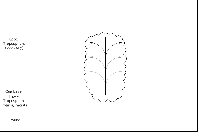
Thunderstorms are powered by heat stored in warm, moist air in the lower troposphere. If the upper troposphere is far cooler, there is "convective potential" (i.e., the warm air wants to rise and the cool air wants to fall, so there is the potential for convective motion).
Usually this convective potential dissipates as fast as it is created, as small thermal updrafts generated by high surface temperatures rise gracefully, displacing cooler air that then falls. Cumulus humilis clouds might form, but these are not thunderstorms.
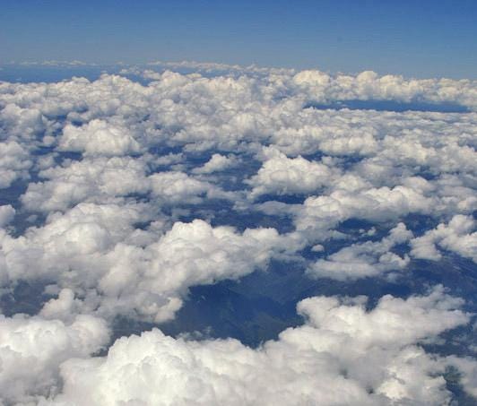
Figure 8. Cumulus humilis clouds, courtesy Bidgee.
If "convective inhibition" is present, an unusually large amount of heat and humidity can build up in the lower troposphere. This requires the presence of a layer of hot, dry air above the warm, moist air at the surface, such that the warm air will not have the buoyancy necessary to rise into the upper troposphere. As the Sun continues to heat the surface of the Earth, air temperatures near the surface increase, above those necessary for thermal updrafts had the hot air not been there. Now the convective potential can build to extreme limits.
So there can be three different layers of air, from top to bottom:
cool, dry air in the upper troposphere,
hot, dry air in the middle, and
warm, moist air in the lower troposphere.
These layers will be stable in this arrangement, assuming that the cooler air on top is far lower in pressure, and therefore is light enough to exist happily above hotter air, and so long as the middle layer keeps the other two layers from coming into contact with each other.
But if the warm, moist air at the bottom gets hot enough to break through the hot, dry air above it, and come into contact with the cool, dry air in the upper troposphere, the results can be explosive. The reason is not so much because of differences in temperature, but because of differences in humidity. When warm, moist air meets cool air, the warm air gets cooled, and its water vapor condenses into precipitation. For the water molecules to change state from gas to liquid (or to solid higher in the cloud), they have to get colder, so they shed their heat into the surrounding air. This is called the release of "latent heat," and so much heat is released by this process that now the updraft will be hot enough to rise all of the way to the top of the upper troposphere, 12 km above the ground.21
The next thing that happens is that a single updraft creates an entire storm. The rising of the initial updraft creates a low pressure underneath it. This reduction in pressure encourages the condensation of water vapor, which releases latent heat, making that air positively buoyant as well. When it rises, it pulls in more air behind it, which does the same thing. In this way, the initial updraft triggers a chain reaction that produces a continuous flow of air from the lower troposphere into the upper troposphere. The result is a cumulonimbus cloud, and this can become a thunderstorm.
Figure 9. Cumulonimbus cloud in Wagga Wagga, NSW, Australia, 2005-11-25, courtesy Bidgee.
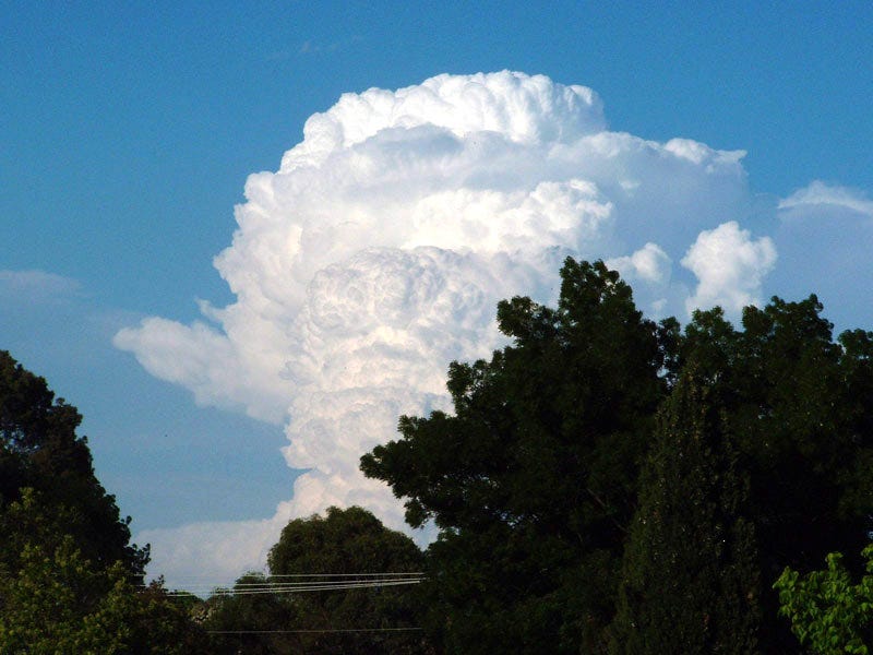
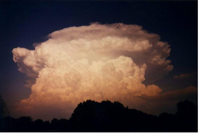
Figure 10. Cumulonimbus cloud, courtesy Grant Firl.
Within the first 1⁄2 hour, a force emerges that might suppress the updraft. As the updraft continues to rise through the storm, air in the middle of the cloud can get "entrained" into the updraft. The reasons for this are poorly understood, and this topic will be treated more thoroughly in a subsequent section. But for now it will suffice to just employ the common notion that the updraft generates a Venturi effect that pulls in air laterally, adding it to the updraft. This typically happens most where there are bursts in the speed of the updraft, because water molecules are changing state, and latent heat is being released. When it happens at the bottom of the cloud, where water molecules go from gas to liquid, the entrainment simply pulls in more warm air from the lower troposphere, reinforcing the updraft. But this also happens in the middle of the cloud, roughly 4 km above the surface, where water molecules are going from liquid to solid.
The initial impact of mid-level entrainment is to weaken the updraft. The air that is drawn into the updraft is cooler, and it reduces the buoyancy. A weak updraft might not survive this process, but a powerful updraft will keep going. If it does, then eventually, the air motion in the upper portion of the cloud resolves into a toroidal flow, with the updraft in the center, and the downdrafts around the outside.
It's significant to note that in fluid dynamics, a toroidal airflow is a very energy-conservative form. Consider, for example, how far a smoke ring can travel, given just a little bit of momentum to start.34 It has no internal strength, and therefore can be easily perturbed. But it is a low-friction, self-stabilizing structure that spins freely in the surrounding air. So if the conditions are right, this form will emerge. In the top half of a thunderstorm, there are upward, outward, downward, and inward forces to establish and maintain the toroidal form, so we can expect this to be present.
It should also be noted that once this form emerges, the air being entrained back into the updraft is no longer cold air, but rather, recirculating warm air. The coldest air in the downdrafts around the outside of the cloud will continue its descent. The air most likely to be drawn back into the updraft will be warmer air that isn't falling as fast. This air will insulate the updraft from cold air entrainment. Hence the toroidal form eventually emerges as a frictionless recirculation of warm air, motivated by the updraft in the center and by the downdrafts around the outside, and that sheds the coldest air away from the updraft.
Figure 11. Air in the middle of the cloud is entrained back into the updraft, setting up a toroidal airflow in the upper portion of the cloud.

After about an hour, powerful and sustained downdrafts will make their way to the surface level, where typically they will put an end to the updraft. At the top of the cloud, precipitation released from the updraft evaporates in the drier air of the upper troposphere. The evaporation process cools the air, increasing its density, and this makes it fall. So downdrafts are created, equal in power to the updraft that initiated them. These downdrafts will head straight for the low pressure under the updraft, filling it with cool air. This cuts off the supply of warm, moist air to the updraft. When this happens, that updraft is finished.
Past this point, thunderstorm activity might begin in adjacent parcels of air. The downdrafts displace warm air at the surface, possibly with enough force to elevate it out of the way. If so, this might trigger a new round of precipitation, and new updrafts will form next to the old one. These new updrafts will follow the same course, and in this way, a lateral chain reaction can develop across the countryside, with updrafts causing downdrafts that then cause new updrafts elsewhere. This can result in a cluster of thunderstorms covering thousands of square kilometers.
Figure 12. Downdrafts undercut the old updraft, and then create new updrafts elsewhere.

The existing thermodynamic model, as described in the previous section, is relatively complete as concerns "normal" thunderstorms. But it falls well short of explaining supercells. A supercell is a single-updraft storm that keeps going for several or many hours, somehow outliving its own downdrafts. Explaining how a single cell can persist for so long, with thermodynamics alone, has proved challenging. There has to be some sort of force that transforms a random set of low-power updrafts into one organized, high-power mesocyclone. But the physics for this organizing force has not been demonstrated.
In the absence of an understanding of what actually causes supercells and tornadoes, a numeric model has been developed, as depicted in Figures 13~15.35,36,37,38,39,40,41,42,43,44 (More sophisticated modeling than this is being done,45,46,47,48,49,50,51,52,53 but the comments below apply equally to both strategies.)
Figure 13. Differences in wind speed and direction result in horizontal rotation in the air.

Figure 14. Horizontal rotation is tilted vertically by an updraft.

Figure 15. The vertical rotation grows into a mesocyclone.

While this model has a certain intuitive appeal, it is not physics. Figure 13 represents a plausible initial condition, as crosswise vortexes in boundary layers are common. But the rest of the model abandons physics in favor of simple constructs that are purely numeric. Such "math" can cause supercells on computer screens, but cannot cause supercells in the atmosphere.
First, Figure 14 describes an updraft powerful enough to rise rapidly into the upper troposphere. But this is not just a simple thermal updraft rising because of high surface temperatures. The only way to get an updraft of the implied speed and force is for warm, moist air to come into contact with cool air, and for there to be the release of latent heat. In other words, a powerful updraft is the result of the convective potential between the upper and lower tropospheres. If a parcel of air crosses the boundary, the potential is released, and the updraft shoots skyward. So it is one of the givens of the construct that because of the robustness of the updraft, it has already crossed the boundary from the lower and into the upper troposphere. And yet another one of the givens is that the boundary between these two layers of air remains distinct, as the crosswise vortex in the boundary persists. These two givens are mutually exclusive. Either the boundary has been crossed, and latent heat is being released, therefore there will be a powerful updraft, or the cap layer is still effective in maintaining the separation between the upper and lower tropospheres, in which case there will be no updraft. There cannot be a powerful updraft and an unbreached boundary separating the upper and lower tropospheres.
Second, even if some truly enormous source of heat at the surface (such as the eruption of a volcano) had generated an updraft capable of rising into the upper troposphere without the release of latent heat, this updraft would not preserve a boundary condition such as a crosswise vortex. When an updraft rises, it does not elevate the air above it, but rather, it burrows its way through that air. The outside of the updraft is slowed by friction with the surrounding air, while the inside is less impeded. This sets up a hemi-toroidal motion at the top of the updraft. The outward splaying at the top of the updraft splits the air into which it is rising. This includes breaching any boundary condition that it encounters, such as a crosswise vortex.
Figure 16. An updraft burrows through the cap layer, and into the upper troposphere. It does not push the cap layer upward.
The only way to get a boundary condition to move as it does in the standard model is to have high pressure below the boundary, and low pressure above it, such that the boundary is simply shifted, without local perturbations. But the forces necessary to do this are simply not present. The energy in a thunderstorm comes from the convective potential across the boundary. This fact cannot be overlooked.
Third, Figure 15 represents the eventual outcome of whatever process(es) created the mesocyclone, but leaves it up to the imagination as to how the boundary vortex morphed into a cyclonic vortex. A boundary vortex requires a constant input of energy from the outside in order to keep it organized. If it no longer has two different bodies of air moving in two different directions on each side of it, it will cease to exist. So even if we could supply enough high pressure below it, and low pressure above it, to tilt it into the vertical position, we would still need to keep a steady stream of air on both sides, going in different directions, to keep this vortex rotating. And this kind of bi-directional motion is simply not present in the upper troposphere. At best, one might say that a powerful updraft rising into a shearing upper troposphere might develop eddies on its leeward side, and these would be vertical-axis, "streamwise" vortexes.36 But streamwise vortexes are no different from crosswise vortexes in that both of them require constant inputs of centripetal force from the outside to stay organized, and this force is supplied by differences in wind vectors outside the vortexes. So there's no way that a streamwise vortex on the leeward side of an updraft will continue to rotate after the updraft has dissipated. And as long as the updraft persists, it is by definition the dominant force. So it will entrain air into itself, robbing air that might have risen into a streamwise vortex on the leeward side. Hence there is no way for a secondary vortex outside of the updraft to become host to a new updraft inside the vortex, initiating the transition to a cyclonic vortex.
All of this leads to the conclusion that there is simply nothing that is physically possible about the standard model of supercells.
So just what kind of theory is this, that clearly violates very basic principles of thermodynamics? The answer is that this is a mathematical model, not a physics model, and there's a big difference. There is a lot of mathematics in physics, but there doesn't have to be a lot of physics in mathematics. It's always possible, and frequently quite useful, to develop mathematical algorithms that mimic the gross characteristics of a phenomenon, even in the absence of an understanding of the physics that is driving those characteristics. For example, if we are doing a coarse-grain study that doesn't need fine-grain specificity below a certain level, we use pure math to instantiate the low-level behaviors that do not concern us. This leaves more processor power available to calculate the higher-level behaviors that do concern us.
For this very reason, meteorologists have developed a mathematical, non-physical model that mimics the gross characteristics of supercells. The granularity of interest is at the level of the cold, warm, and occluded fronts (which are far larger than the storms themselves) that create the potential energy. The actual form that the energy release takes within the storm is considered to be an effect rather than a cause. As such, there is no need to model the storm-scale behaviors with mechanistic physics, and simple mathematical algorithms are the more economical alternative. Due to the statistical relationship between wind shear and supercells, the standard model starts there. How does wind shear produce a mesocyclone? Crosswise vortexes in boundary layers are common, and fluid dynamic software to model such vortexes had already been developed. Once instantiated, the crosswise vortex can then be programmatically modulated into any other form, such as a mesocyclone. In other words, software can do things that physics cannot.
So what's the point in writing software that behaves in ways that cannot possibly happen in nature?
The objective in such "modeling" is simply to create a calculation engine that can associate preconditions and outcomes. In other words, once the software can take a crosswise vortex in a shearing boundary layer and turn it into a mesocyclone (which physics cannot, but that doesn't matter), the software can then be tweaked to produce the right mesocyclone from the given shearing conditions. So if we know that it takes a certain amount of shear (not too much and not too little) to produce the most robust mesocyclones, we can modify the software to favor those conditions when deciding how much mesocyclonic enhancement to apply to the output. With successive trials we can fine-tune the algorithm until the output matches the field data.
There are actually a number of thermodynamic factors that are statistically related to the chance of a mesocyclone becoming organized. Wind shear (including the elevation of the boundary, the difference in the directions of the winds, and the difference in speeds), temperature, and humidity are all acknowledged in the thermodynamic calculation engine, and these are routed into the custom mesocyclone generator. The result is a predictive tool that performs well above chance.
But there are two very fundamental problems with this model.
First, thunderstorm prediction using thermodynamics is fairly reliable, but mesocyclone prediction is not. The rare 1 in 1000 case should be easy to predict, because it should take rare conditions to produce. But it's becoming clear that whatever those conditions might be, they are not registering in the data that we're currently collecting. This shouldn't be a surprise, since all attempts at modeling mesocyclones just with thermodynamics have failed. A common opinion among researchers is that they failed because they still haven't found the exact fine-grain conditions that must be present for the fluxes to fall into the mesocyclonic pattern, but this is naïve. Even if we set up a mature mesocyclone in a Navier-Stokes engine and let it run, the mesocyclone falls apart. There is some sort of organizing principle in a mesocyclone that we just don't understand. This will be covered in more detail later, but at this stage in the analysis, the significance is that this proves that non-thermodynamic (i.e., electromagnetic) factors have to be present, and purely thermodynamic modeling (statistical or mechanistic) will never predict mesocyclones with a high degree of accuracy.
Figure 17. Factors used in the operational prediction of severe weather, courtesy NOAA.
Second, only 1⁄4 of all mesocyclones produce tornadoes,54 and recent research demonstrated that even with fine-grain in situ data, supercells that produce tornadoes are difficult to distinguish from those that do not.33 So even if we could predict mesocyclones accurately just with thermodynamics, we're still stuck with a 77% false alarm rate from all of the mesocyclones that didn't produce tornadoes, and lost time due to false alarms has been cited as the source of the largest economic impact of tornadoes.5 Furthermore, the existing model provides no way of predicting the strength of the tornado that will form. Of the 23% that are not false alarms, only 26% of the cases (or 6% of all warnings) become EF2+ tornadoes, which are responsible for 96% of the tornado-related fatalities. If we considered it to be a false alarm if there was no EF2+ tornado, the false alarm rate would be 94%. At that rate, the general public doesn't take the warnings very seriously, meaning that the entire enterprise has yet to deliver on its promise.
Sooner or later, all will agree that the thermodynamic regime has passed the point of diminishing returns, and that the only way to improve the accuracy and lead time of tornado warnings is to build a new model that takes electromagnetism into account. The present work anticipates that conclusion, and describes just such a model.
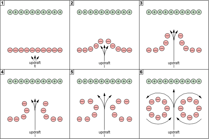
In any thunderstorm, there is a charge separation between larger precipitation, which is negatively charged, and smaller bits of precipitation, which are positively charged.55,56,57 Over time, a net negative charge accumulates in the middle of the cloud, as the heavier precipitation descends toward the ground, while a net positive charge accumulates at the top of the cloud, where small, positively charged ice crystals linger, too light to fall at a measurable rate.58,59 The electrostatic potential between the ground and the negative charge in the middle of the cloud is typically in the tens of millions of volts. The potential between the ground and the positive charge at the top of the cloud can exceed a hundred million volts.60
In a supercell, there is an unusual lack of precipitation falling out of the cloud as the storm develops,39 and there is an unusual build-up of negative charge in the middle of the cloud. It's possible that the negatively charged precipitation is being held in suspension by an unusually strong positive charge at the top of the cloud.22 The source of the positive charge would be earlier thunderstorm activity.61,62 This powerful positive charge could simply be the result of one storm lasting an unusually long period of time, and its own positive charge simply continuing to accumulate. It could also be the result of the positively charged anvil of one thunderstorm overhanging another thunderstorm.63
Figure 18. Main charge regions develop in the cloud.

Once the main negative charge region develops in the middle of the cloud, there is good reason to believe that mid-level entrainment will pull the negatively charged precipitation back into the updraft.64,65
All other factors being the same, the updraft does not have a net charge. It starts out being neutrally charged. When precipitation first forms inside the updraft, it is neutrally charged as well. Interactions among the ice crystals that form at higher altitudes result in a negative charge being transferred to whichever particle is heavier. But at that point, no charge separation has occurred, and the updraft still has no net charge.
But once gravity separates out the heavier precipitation into the main negative charge region, and entrainment pulls these negatively charged particles back into the updraft, the updraft will then be bearing a net negative charge. When the negatively charged precipitation recirculates through the downdrafts and back into the updraft, the downdrafts become charged as well.
If we combine what we know about the fluid dynamics of a developing thunderstorm with what we now know about the main charge regions, a new picture emerges. But to bring it into focus, we first need to clarify the fluid dynamic component.
It was stated previously (in the section entitled "Thermodynamics") that the updraft generates a Venturi effect, resulting in mid-level entrainment. The entrainment itself then joins the existing upward, outward, and downward motions, resulting in a continuous loop of recirculating air. We know that this happens. And the conventional explanation certainly credits the Venturi effect for causing the entrainment.
But this isn't accurate enough for inclusion in a mechanistic construct. Crossing the freezing line does release latent heat, as the water molecules go from liquid to solid, but to think that there will be a "burst" in speed sufficient to create a Venturi effect is just not correct. When water molecules go from gas to liquid at the bottom of the storm, they release 7.5 times more heat than when they go from liquid to solid in the middle of the storm. So we should actually expect the mid-level state change to merely relieve some of the back-pressure on the expansion from the low-level state change.
To visualize this, imagine a burner with an exhaust plume that rises into the open air, and suppose that some distance above the burner, we mount a catalytic converter that causes secondary combustion of the remaining fuel. Suppose that the secondary combustion releases 1⁄7.5 the heat as the primary combustion at the bottom. We would hardly expect the secondary combustion to create a burst in speed sufficient to entrain fresh air from the sides of the plume. Rather, the plume that was accelerated from the primary heat source fights friction as it rises, so it is slightly higher in pressure than the ambient air. A (miniature) burst in speed above it will relieve that pressure. It will not leave that high pressure to fend for itself, and generate the low pressure necessary to pull air laterally into the flow.
This means that the conventional "explanation" for mid-level entrainment is just an observational rationalization, and properly put, it is anomalous. As fluid dynamics can't explain it, we'll look to EM principles to resolve the issue mechanistically.
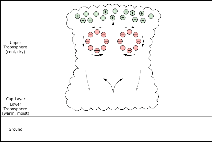
We must also clarify our concept of the general context in which mesocyclones form. The standard models have rotation beginning as a stretched crosswise vortex in the cap layer, or in a streamwise vortex on the leeward side of the updraft. Either way, the rotation is said to originate at the base of the updraft. Yet the evidence indicates that rotation begins in the top half of the storm, and then migrates and/or extends downward from there.40,66,67,68,69 In fact, developing mesocyclones frequently display a well-formed hook echo 5 km above the ground, when there is little to no rotation at the base of the updraft. So we should focus our efforts on understanding the development of mesocyclones in the top half of the storm, where a robust toroidal recirculation has (inexplicably) emerged, in the presence of the main positive and negative charge regions.
Figure 19 shows how a well-organized recirculation could develop in the given conditions.
A new updraft intrudes on an existing main negative charge region.
The updraft elevates the air into which it rises. Note that the main negative charge region has electrostatic pressure. So the charges flow vigorously toward the void left by the elevated charges.
The updraft breaks all of the way through the layer. At this point we'd normally expect the elevated air to settle back down to its original altitude, instantiating boundary vortexes between itself and the updraft. But this air has electrostatic pressure, so it will more likely splay outward.
The splaying continues, and electrostatic pressure pushes new air to replace the elevated air.
Outwardly-flowing air begins to fall as it seeks its equilibrium altitude. When it encounters the downdraft at the outside, it falls rapidly.
The upward, outward, and downward aerodynamic forces, and the electrostatic pressure, resolve into a continuous toroidal flow.
Figure 19. Main negative charge region morphs into a toroidal boundary vortex.
Once this form emerges, it becomes the solitary boundary layer vortex between the updraft and the surrounding air in the top half of the storm. At the same time, it eases friction below the expanding anvil, and helps shed downdrafts to the outside, away from the updraft. Electrostatic pressure then closes the loop into a continuous, frictionless structure.
As mentioned previously, toroidal flows are energy-conservative, and are easy to establish and maintain. This particular toroid should be especially robust, as it has energy sources on three sides. Furthermore, the electric charges will help organize the form. Charged air is capable of greater laminar speeds, because electrostatic repulsion discourages the low and high pressures inherent in turbulent flows.25,26,27 Hence electrostatics endows the toroid with a degree of rigidity that we would not otherwise expect, and this enables a faster, laminar flow, without boundary vortexes between it and the updraft, anvil, or downdrafts. Essentially, it becomes a rigid but free-wheeling structure that organizes the surrounding flows, and itself achieves the same speed as the updraft, anvil expansion, and downdrafts. In this context, robust mid-level "entrainment" goes from inexplicable to inevitable.
Figure 20. Toroidal airflow becomes organized.

We should also note that the toroidal recirculation of negatively charged rain and hail will gain a lot more rigidity as a positive double-layer develops.
Positive double-layers (also known as "shielding" or "screening" layers) are a well-known phenomenon, where negative charges suspended in the middle of the storm attract positive ions, forming distinct layers of opposite charge. The source of the positive charge is virga falling out of the positively charged anvil. When this evaporates, it creates downdrafts, which are then attracted to the main negative charge region by the electric force.
Ordinarily, strong electric fields between oppositely charged layers don't last long in a fluid medium. The electric force is so powerful that it takes a rare set of circumstances for electrostatic potentials to develop without getting neutralized as fast as they are created. But in thunderstorms, and especially in supercells, such circumstances exist. Heavier precipitation tends to pick up a negative charge, while smaller bits of precipitation get positively charged. The heavier precipitation has a higher terminal velocity, so it falls faster, while the lighter precipitation is held in suspension in the anvil of the cloud. Hence a combination of gravity and terminal velocity creates the charge separation in a thunderstorm.
If the charge separation process puts several kilometers of distance between the negative and positive charges, it will take tens of minutes for the charged particles to work their way past the aerodynamic resistance in order to recombine. In the meantime, positively charged downdrafts will be attracted to their negatively charged correlates due to the electric force, while buffered from them by the aerodynamic force.
So Figure 20 is correct but incomplete, and we need to add a layer of positive charge all of the way around the main negative charge region. It is motivated by all of the same forces as the negative charge region, while it is positioned to the outside because negatively charged precipitation fell out of the anvil earlier.
Figure 21. Toroidal flow with positive double-layer.

The significance of a positive double-layer involved in the toroidal airflow is that it has more aerodynamic force. The negative charges in the storm are concentrated in larger particles that exert a small force on the surrounding air. But an equal amount of positive charge will have a lot more surface area. The loss of electrons due to ionization shifts the matter along the solid~liquid~gas~plasma series of physical states. Hence the charges in the positive double-layer will be found in a larger number of smaller bits of matter. The increase in surface area then increases the aerodynamic force. The more distributed charge will also be far more effective in delaying the transition to turbulence, meaning faster speeds.
Considering the air speeds in question, the negative and positive charges will make a full round-trip in the toroidal flow long before they have a chance to recombine. And at the top of the loop, the charge separation will be refreshed by the effects of gravity and terminal velocity.
9. Effects of EM on Supercells
Having good reason to believe that a robust toroidal recirculation exists in the top half of the cloud, motivated by the thermal forces and stabilized by electrostatic pressure, we should then consider the effects that this will have on the developing thunderstorm.
As already mentioned, the toroidal flow will eliminate turbulence in the boundary layers surrounding the updraft, along the bottom of the anvil, and on the inside of the downdrafts. This will increase the speed of such flows. Interestingly, the faster the system runs, the more effective the charge separation. Given enough time, opposite charges will recombine, and such a structure will cease to exist. The faster the toroid spins, the more frequently the charge separation gets refreshed at the top of the storm. And the more the charge separation, the more powerful the structure. So this constitutes a positive feedback loop.
And if we look at the bottom of the toroid, we see another important effect. The inward flow will funnel all of the updrafts from lower in the storm through a single laminar channel. Hence the reinforced toroidal flow will concentrate the energy of numerous small updrafts into one big updraft racing to the top of the cloud.
Figure 22. Effects of organized recirculation in the top half of the storm.

A faster updraft means more air being pumped into the anvil, which will expand faster, and which will manufacture more precipitation in a shorter period of time, which will increase the speed of the downdrafts, which will increase the mid-level "entrainment," which will further consolidate the updraft. So a force multiplier (i.e., a consolidated updraft) has been added to an existing positive feedback loop, creating a runaway system.
Note that this runaway system is not creating any energy, and thereby violating the First Law. The energy budget of a supercell is unmistakably thermodynamic, and any electromagnetic forces present have to be conversions from thermal potential, or the energy budget isn't going to work out. But the proposal here is not that the total amount of available energy in the system is being altered. What's being altered is the rate at which work is being performed. And there is no fixed law there, except that all of the factors have to be taken into account, and if the circumstances favor the acceleration of the prime mover, the whole system will run faster, until all of the energy has been expended. And we definitely know that something is altering the rate at which work is being performed. We just can't get there with thermodynamics alone.
To look at it another way, it's the same amount of energy, but the organized toroidal form is consolidating all of the energy released in a small convective complex into one single updraft. So we could have random 30 m/s updrafts in a cluster of thunderstorms covering 10 km2, or we could have one steady 80 m/s updraft, 2 km wide, in a supercell — same energy either way. With thermodynamics alone, we just don't have the organizing principle that will affect this transformation. But with a little bit of encouragement from electromagnetism, the rough thermodynamic form resolves into an organized structure. The consolidation of energy and the reduction in turbulence then results in faster speeds, and this further encourages the form.
So where is the mathematical support for such contentions? Typically this would be a very reasonable question, but consider the complexity of the problem. Reliable estimates of turbulence thresholds are derived experimentally, not theoretically. Not being able to reproduce a supercell in a laboratory (mainly because of the scale-dependent pressure gradient in the atmosphere), we'd have to attempt a computer simulation with the turbulence threshold determined heuristically. The aerodynamic forces would have to be calculated separately for the negative inner core and for the positive double-layer, using guesswork to flesh out incomplete charge density datasets, and then the fluid dynamic interplay between the two layers would have to be estimated. Getting the electric force just strong enough to influence the flow, without overpowering it, would take a lot of trial and error, as near-infinitesimal amounts of extremely powerful forces are always tough to estimate. And after guessing at everything, what will an exact solution prove? It will prove merely that this might be correct. But we already knew that.
We would prefer simulations in which we could expect more stable behaviors, and that would mean working with moderate forces. But if the factors that produced supercells were within normal ranges, supercells would be the norm, not the 1 in 1,000 case. So we cannot rule out unexpected behaviors from forces well outside their normal ranges — we must rule in only those constructs that operate at such extremities — even if simulating them would be extremely difficult.
It's clear to all of those who understand the problem that numeric proof is beyond the reach of current technology. So there is little that can be done. But we can still do more than we are doing now. At the very least, we can begin constraining ourselves to what is physically possible, which the present proposal appears to be. The existing constructs do not meet this criterion, and the increase in rigor would mean that we're making progress. And we can make comprehensiveness a hard constraint. Tornadic supercells have many distinctive properties. No previous proposal has directly addressed the great diversity of phenomena in the problem domain. If we are now considering a possibility that passes a comprehensive range of tests, there will be far fewer reasons to think that we don't know what we're doing.
Therefore, the reinforced toroidal form, with a negative inner core and a positive double-layer, is proposed to be the organizing principle that initiates the transition from a normal thunderstorm to a supercell. The section entitled "Toroids to Mesocyclones" will describe the metamorphosis from a toroidal to a mesocyclonic flow, from which the tornado will ultimately descend.
It cannot be overstated that this is neither an electromagnetic nor a thermodynamic construct. It is a thorough integration of electromagnetic and thermodynamic factors in a unified framework, producing behaviors not possible within either regime all by itself. So it's not an unusually robust open-air thermal system, and it's not a low-energy plasmoid in a high-friction environment. It's thermal fluxes generating charge separations that then modulate the thermal fluxes. To understand these systems, we have to see electromagnetism and thermodynamics as fully intertwined sets of principles.
The study of coupled electromagnetic and thermodynamic forces is a young discipline. Here is a quote from a recent work that describes the types of problems that are being tackled with such interdisciplinary methods.70
Electro-Magneto-Hydro-Dynamics (EMHD) addresses all phenomena related to the interaction of electric and magnetic fields with electrically conducting or magnetic fluids. Electric and magnetic flow control, for example, is a challenging area of mathematical and engineering research with many applications such as the reduction of drag, flow stabilization to delay transition to turbulence, tailored stirring of liquids, pumping using traveling EM waves, and many others. The application of electric and magnetic fields in diverse branches of materials science such as crystal growth, induction melting, solidification, metal casting, welding, fabrication of nanofibres, fabrication of specialty composites and functionally graded materials, or ferrofluids is recently of growing interest. Fully coupled EMHD systems, that is, in situations where the flow-field is influenced by the electric and magnetic fields and where these fields are in turn influenced by the flow-field, are challenging research subjects with applications in geo- and astrophysics (dynamo, magneto-rotational-instability, etc.). Numerical simulations of many important processes (the growth of single crystals, metal casting for aerospace applications, aluminum electrolysis, etc.) require sophisticated tools for coupled fluid flow ~ heat/mass transfer ~ electromagnetic fields. In summary, computational EMHD is a vital subject of recent research with a long list of interdisciplinary applications and scientific problems.
The present work studies tornadic supercells as charged gases, where the gases also contain charged liquid and solid particles. The gases obey fluid dynamic laws, though the viscosity is modulated if the gases are charged. Electric fields also exert forces on charged particles, which then exert aerodynamic forces on the gases. The larger particles are also subject to gravitational and inertial forces. Heat sources and sinks alter the density of the gases, which in the presence of gravity results in fluid motion. Such a crossroads of all other disciplines puts this work squarely within the domain of EMHD. This paper will then use "EMHD" to refer to this particular interaction of forces, and the framework that emerges, when clarity requires that the regime in question be identified. At some later date, some sort of term might be coined for this particular EMHD construct, if anyone else begins actively developing a different treatment of the topic using EMHD principles. In the meantime, please consider expediency and disdain for arbitrary coinages, not presumptuousness, to be the reasons for calling this the EMHD construct.
Figure 23. Top of supercell that produced an F4 tornado in La Plata, MD, 2002-04-28, courtesy Steven Maciejewski.
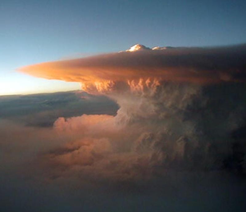
Figure 24. Schematic of supercell thunderstorm, courtesy NOAA, redrawn by Vanessa Ezekowitz.

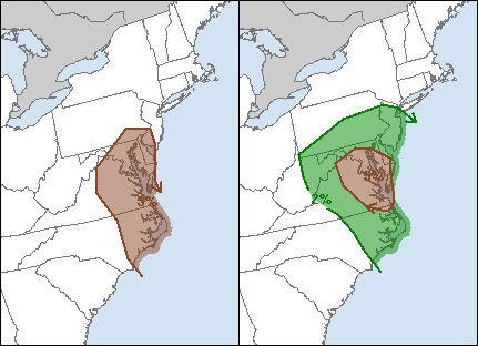
The conditions conducive to both hail and tornadoes are similar, and meteorologists forecast both phenomena in more or less the same way, though hail is far more common than tornadoes, so the hail outlooks typically cover more area. (See Figure 25.)
Figure 25. Similar hail (left) and tornado (right) outlooks for 2011-10-13, courtesy NWS.
Since hail and tornadoes are coupled, we can test the EMHD model of supercells by considering how it would account for hail. At this point, the model only describes the embryonic mesocyclone, wherein a reinforced toroidal recirculation has emerged (while the transition from a toroidal to a mesocyclonic flow is yet to be presented in the section entitled "Toroids to Mesocyclones"). But we also know that hail begins to form within the first 10 minutes of the thunderstorm becoming organized.71 So the model of the embryonic mesocyclone (still in toroidal form) should be capable of explaining hail.
Existing theory states that hail forms at the top of the updraft, where precipitation released from the updraft falls back through the updraft, colliding with other precipitation, creating larger aggregates.72 While it's unquestionable that this does happen, it can't be the whole story. The terminal velocity of precipitation when it first forms is lower than that of dust, which follows the motion of the air first and the force of gravity last. Furthermore, to the extent that gravity is a factor, it acts on all of the particles in the same way. So all by itself, gravity does not create particle collisions. If the particles were much larger, and of different sizes, they would have different terminal velocities, and therefore would fall at different speeds, resulting in particle collisions. But how can they collide and create larger aggregates before there are aggregates of different sizes?
Further still, the same standard theory also states that wind shear must be present in order for a thunderstorm to develop to extreme limits. The reason given is that without wind shear, the updraft will be perfectly vertical, and precipitation released at the top of the updraft will fall back down, through the updraft. When it does, some of the precipitation will evaporate, cooling the air and creating a downdraft right on top of the updraft, snuffing it out.37,71 Aside from the question of how microscopic ice crystals are going to "fall through" an updraft, this begs two more questions. First, how does precipitation evaporate in an updraft that is already at its dew point and the temperature is still dropping (otherwise it wouldn't be forming precipitation that can "fall back down")? Second, the more severe the thunderstorm, the more hail it produces. If wind shear has to be present in severe thunderstorms (to prevent capping downdrafts), wouldn't they produce less hail? It's clear that some of the tenets in the standard model are mutually exclusive, and that we're missing something fundamental.
First we need a framework for understanding how large aggregates of water molecules can form, sometimes within the first 10 minutes of a cumulonimbus cloud becoming organized.71 Then we'll ask about the specific characteristics of hail.
The accretion of water vapor into supercooled aerosols and ice crystals, in such a short period of time, obviously needs help from a force more powerful than just random covalent bonding. The most likely candidate is the dipolar nature of water molecules. In the fair weather field (100 V/m),73,74 the electric force will not affect the translational velocity of the (as yet neutrally charged) molecules, but it will polarize them, and this means that with respect to neighboring molecules, each will show opposite charges to the other, resulting in an electrostatic potential between them.75,76 This will greatly increase the chance of molecular aggregation. If a crystal lattice is already present, new molecules will contribute to the existing solid; otherwise, they will join the supercooled aerosol.
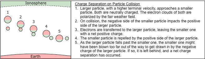
Figure 26. Dipolar water molecules get aligned by the fair weather field, and then are attracted to each other. Green = positive; red = negative.

Still in the presence of the fair weather field, the aggregates then become dipoles on a larger scale, showing a positive charge at the bottom (facing the negatively charged Earth), and a negative charge at the top (facing the positively charged ionosphere). This sets up the conditions necessary for electron transfer in particle collisions. A larger particle falling through the field, showing a positive charge on its bottom, will be attracted to a smaller particle in its path, which is showing a negative charge on its top. When they collide, electrons are transferred to the larger particle, and are absorbed by its electron cloud. This leaves the smaller particle positively charged, which is then repelled by the positive face of the larger particle. When the larger particle falls past the smaller one, there are two possibilities. Either the smaller particle will fall in with the larger particle, attracted to the negative charge at the top of the larger particle, in which case the two particles will merge, or the smaller particle will have been blown too far out of the path, in which case it will be left behind with a net positive charge, and with the larger particle gaining a net negative charge. Obviously, both of these outcomes occur, and both are easy to understand in this framework.
Figure 27. Charge separation.
Then, as larger, negatively charged aggregates fall because of a higher terminal velocity, the main negative charge region develops below the main positive charge region in the storm. This field has the same orientation as the fair weather field (between the negatively charged Earth and the positively charged ionosphere). Hence the emerging charge separation enhances the existing field, and strengthens the molecular/particulate dipoles, which increases the chance of collisions, which increases the accretion rate and the charge separation process.
Such can explain the development of large water particles, and the main charge regions in the storm. But explaining hail will take more than that. The distinct layers in a hailstone cannot be adequately explained as simple "wet growth," in which supercooled aerosols adhere to an existing ice crystal. Some of the literature suggests that when the aerosols freeze, they release enough latent heat to thaw the surface to which they adhere, creating a distinct layer. But for this to be true, the aerosols would have to be just below freezing themselves, and hail only forming in that part of the cloud where the temperature is within such a narrow range would not account for the amount of hail that is actually produced. It is also inconsistent with the simultaneous appearance of hail below the freezing line (less than 5 km above ground), and also far above it, where the temperatures are between -30 °C and -50 °C (8 km or more above ground).77,78 Some researchers believe that there are two separate processes involved,71 but this begs the question of what couples those processes such that they start producing hail at the same time, and of the same size.
So other researchers favor the "particle fountain" idea, in which a relaxed updraft allows precipitation to fall below the freezing line, where some melting occurs. Then, the next surge in the updraft hoists the aggregates above the freezing line, and the liquid freezes into a new layer. But with distinct layers only 2 mm thick, a golfball-size hailstone (r = 22 mm) would have to go through 11 cycles of this without falling out of the updraft, which is hard to believe (especially if it's a severe thunderstorm, with a tilted updraft). It's also hard to believe that the "particle fountain" would be so good at producing layers of such consistent thickness per stone, when random surges in the updraft should produce random layering. All the more problematic is that this puts air-cushioned hailstones, which are the best radar reflectors in the cloud, inside the bounded weak echo region (BWER), where we should expect no hail at all.
Interestingly, recent simulations of hail-producing storms acknowledge the existence of upper-level recirculation,78 as in Figure 28. A recirculation pattern that straddles the freezing line easily accounts for the emergence of refrozen precipitation, in that period of time, with that many layers, below and well above the freezing line at the same time.
Figure 28. Modelled airflow, including well-defined recirculation, in a hail-producing storm, courtesy Meteorology Press.

Consider, for example, a toroidal recirculation emerging within the first 10 minutes of the thunderstorm achieving full depth. Let's suppose that the toroid has a diameter of 1,000 m at that stage, with a circumference of 3,142 m. If the air is rotating at 50 m/s, it will make the round trip in roughly one minute (3,142 m / 50 m/s = 62.84 s). At 2 mm per pass, in 10 minutes a hailstone will grow to a radius of 20 mm. At that size it will have a terminal velocity of 15 m/s, which means it will still be too small to fall out of the upward component of the rotation (at 50 m/s), but in the 1,000 m of horizontal motion along the bottom of the recirculation (which it travels in 30 seconds), it will fall 450 m — perhaps enough to get it out of the recirculation. Otherwise, the hailstone can become as large as a baseball (r = 37 mm) within 20 minutes simply by wet growth.
While upper-level recirculation is the far more likely mechanism responsible for hail, one question is left open. It's undeniable that there is a strong relationship between wind shear and severe thunderstorms. If it's not because of an absence of "capping downdrafts," then what is the actual nature of the relationship?
The more likely correlation has to do with thermodynamic factors at the bottom of the storm, rather than the top. The tilt in the updraft will cause the downdraft to fall further from the bottom of the updraft, reducing the chance of undercutting the updraft. A downdraft that hits the ground close to an updraft, but without undercutting it, will actually accentuate the updraft, because it displaces warm air that then joins the updraft with force.79
Figure 29. Wind shear prevents downdrafts from undercutting the updraft.

Combining the contentions in this and the previous section, a far more plausible description of the general nature of supercells becomes possible.
If wind shear is present, the downdraft will not undercut the updraft, and an endless supply of thermal energy in the lower troposphere can feed the storm in the upper troposphere. Now the storm can last much longer than an hour.
The longer the storm lasts, the more positive charge accumulates at the top of the cloud, and the more negative charge is held in suspension in the middle of the storm, establishing powerful main charge regions.
If the air is charged, electrostatic forces will encourage the establishment of an organized toroidal flow that will consolidate the updraft and delay the transition to turbulence, resulting in a much faster flow, and a more powerful toroidal structure. As the recirculation straddles the freezing line, hail begins to form.
The far more powerful updraft will then be able to pull in air from a much wider area, and the single-cell storm will grow to enormous proportions.
Note that in EMHD, electromagnetism and thermodynamics are peers. Neither dominates, and neither can be forgotten, in a complete description of the phenomena.
Figure 30. Supercell that dropped hail accumulating to 12 inches on the ground in Chaparral, NM, 2004-04-03, courtesy Greg Lundeen.
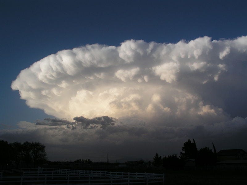
So far, the EMHD model has a toroidal recirculation of the air in the top half of the storm that creates a runaway system. Yet the defining characteristic of a supercell is its rotating updraft — the mesocyclone.39 (Its name belies the ancient assumption that hurricanes, supercells, and tornadoes were all manifestations of the same principles, on 3 different scales, and all were called "cyclones."80 We now know that these are fundamentally different phenomena, yet the names persist.) And there is a fundamental difference between toroidal and mesocyclonic airflows.
There is a growing body of evidence that mesocyclones develop in the upper portion of the cloud, sometimes producing well-defined hook echoes 5 km above the ground, and then they extend or migrate down to the base of the storm.40,66,67,68,69 Existing models do not take these data into account. An uplifted crosswise vortex, or a streamwise vortex on the leeward side of an updraft, would have the rotation begin in the bottom half of the storm, if these were, indeed, realistic models anyway. So the EMHD model, focusing on the top half of the storm as the origin of the mesocyclone, is starting in the right place. But the data tell us that if a toroidal airflow does develop, it evolves into a mesocyclonic flow, before the structure descends.
Assuming that a powerful recirculation has become organized, and assuming that wind shear is present in the top half of the storm, rotating mid-level "entrainment" is easy to understand. Suppose that the mid-level winds are from the south, and the top-level winds are from the west. Air pouring out of the updraft will get blown to the east, and more downdraft air will fall on the east side of the system. As this downdraft air is drawn back toward the updraft, the southerly winds offset the air to the north. Air being pulled westward, but also being offset to the north on the way, will then spiral counter-clockwise toward the updraft. Figure 31 shows the dominance of CCW inflow, where the black dots represent sources of air (i.e., the downdrafts), and where the air converges on a central vacuum (i.e., the updraft). In a non-linear simulation, this would resolve into a cyclonic pattern.
Figure 31. Flow lines at bottom of toroidal airflow (mid-level entrainment), in plan view, with wind shear. Fluid dynamics applet by William Devenport.
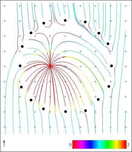
Figure 32 is a rough representation of the general form of a toroidal recirculation that has been skewed and twisted by wind shear. If the lower-level winds are traveling in the +Y direction, and the upper-level winds in the +X direction, the updraft (+Z) will tilt in the +X direction, while along the bottom of the recirculation, air will be offset in the +Y direction by the lower-level winds, inducing rotation. The algorithm used to generate the image then makes a continuous geometric pattern out of it.
Figure 32. Skewed and twisted toroid.
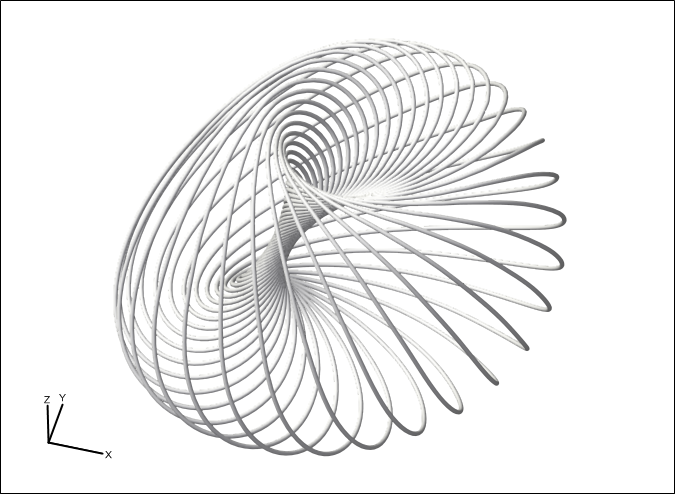
Functionally speaking, the skewed and twisted toroid will have more or less the same properties as a simple toroidal flow. It is still motivated by the updraft inside, the anvil above, and the downdrafts to the outside, with mid-level "entrainment" closing the loop along the bottom. We also shouldn't expect the twisted toroid to be any worse in funneling all of the updrafts below it into the center. In a cyclonic regime, the net effect on lower air rising up into the mesocyclone will be to funnel the air toward the center, even if there is also a rotating counterpart to the motion.
It's even possible that the rotating sheath accentuates the updraft. Negatively charged precipitation in the rotating recirculation will be centrifuged outward. We would expect it to be ejected tangent to the rotation, except for the fact that it experiences an electrostatic attraction to the positive double-layer, which at this point in the recirculation is the inside layer. The net effect is that the positive double-layer will be pulled outward, to the extents of what the drop in hydrostatic pressure allows. The limiting factor is how fast the sheath can pull in air from below to satisfy the vacuum created by the centrifugal force. In other words, the rotation will increase the suction at the base of the mesocyclone.
Note that this actually represents a fundamental reconception of the nature of a mesocyclone. In the standard model, a mesocyclone is a rotating updraft. But when we observe that the mesocyclone gets established in the top half of the storm, this is untenable. As noted in the section entitled "Electromagnetic Toroids", the updraft begins at the base of the storm, where the primary release of latent heat is 7.5 times greater than the secondary release in the middle of the storm. So we truly have no reason to believe that there will be any Venturi Effect entraining mid-level air into the updraft, much less the kind of powerful entrainment that could develop a well-defined cyclonic inflow pattern several kilometers wide, 5 km above the ground. Rather, the "entrainment" is actually just the bottom segment of a continuous recirculation. Once the air gets to the center, it doesn't get pulled into the updraft — it forms a sheath around it. This means that it's not the updraft that is rotating at all — it's the "entrainment" that is rotating, and the mesocyclone is a skewed and twisted toroidal boundary vortex that consolidates the updraft and eliminates friction between it and the surrounding air.
Once a mesocyclonic flow gets established in the top half of the storm, it then extends and/or migrates downward. As airspeeds increase, the mesocyclone is able to pull air from lower in the storm, where there is far more energy. (The release of latent heat at the bottom of the storm, where water molecules go from gas to liquid, is 7.5 times more powerful than the liquid-to-solid release in the middle of the storm.) Hence we can expect airspeeds to increase as the size of the mesocyclone grows.
As the mesocyclone extends downward, the structure of the recirculation changes as well. In the top half of the storm, we can expect enough wind shear to get the downdrafts to be offset from a concentric circle around the updraft. But if the downdrafts begin at the top of the storm, and fall all of the way to the bottom, there will be enough wind shear to get them to fall entirely on the leeward side of the updraft. The next four figures illustrate a metamorphosis, from a toroidal recirculation in the top half of the cloud, to a mature mesocyclone dominating the entire storm.
Figure 33. Toroidal flow in upper half of storm.

Figure 34. Wind shear skews and twists the toroid into a mesocyclone.
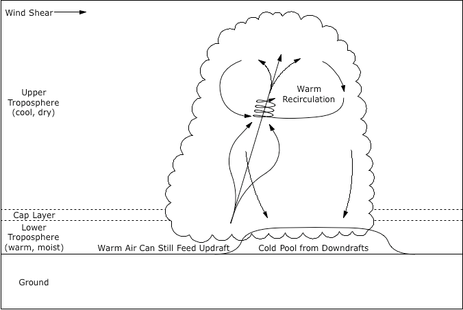
Figure 35. Mesocyclone extends downward. Note that wind shear carries all of the downdrafts to the leeward side of the storm, where they merge.

Figure 36. Mesocyclone achieves full height.

Figure 37 shows a 3D representation of the reflectivity within a tornadic storm. (Red means > 50 dBZ; orange means 43~44 dBZ. Note that this scan leaves out the bottom 1 km or so of the storm, since Doppler radar can't see below 0.5° above the horizon, because of ground clutter issues. Nevertheless, the base of this storm was about 1 km above the surface, so we're not missing much, except the rain under the hook echo, and of course, the tornado.) The reflectivity thins out at the top of the updraft, so we can't see the complete loop, but the updraft is clearly visible, and we can see the precipitation in the forward flank downdraft feeding directly back into the updraft. The tubular structure of the recirculation (sometimes called "cave channels"77) is also clearly visible on the right-hand side of the image.
Figure 37. Volumetric reflectivity of the storm that produced an F5 tornado in Moore, OK, 1999-05-03, courtesy GRLevelX.
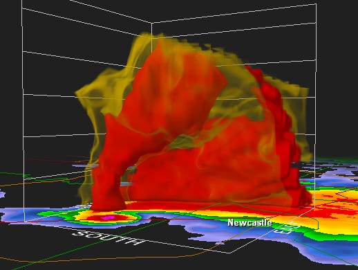
At first blush, the conventional thinking on the structure of the mature mesocyclone seems intuitively accessible. A powerful updraft is pulling air from all around, and cyclonic inflow patterns are common in nature. But the mesocyclone in Figure 37 was running at full speed at the time of the scan (with an F5 tornado in progress), and the source of the energy was downdraft air, being drawn upwind, from 10 km away, faster than the storm was pulling warm, moist air in through the flanking line? Wet downdrafts extinguish updrafts, if the rest of what we know about thermodynamics is true. And it makes no sense whatsoever that a channel of air is getting pulled against the prevailing winds into a low pressure.
.png)
Understanding this scan in mechanistic terms requires that we openly acknowledge that the updraft doesn't have a right to pull downdraft air back into the updraft from that far away. Such constitutes direct evidence of the presence of factors other than just simple thermal buoyancy. In fact, what we see here is a phenomenon known as "channeling," wherein a band of air is being preferentially pulled through other air. In fluid dynamics, this is only possible when there are major differences in viscosity, and the low-viscosity substance experiences less friction tunneling through the high-viscosity substance, even as it travels a greater distance. That begs the question of what could cause such a big viscosity difference in the air. If the air is charged, electrostatic repulsion prevents the particle collisions that instantiate friction, allowing it to flow more freely. So this has to be charged air.
Then we just have to account for the fact that the updraft is running at extreme limits, with its only visible means of support being negatively buoyant downdraft air. There's no way to make that energy budget work, so there has to be another source of energy, and there has to be a way to keeping the cold downdraft air from mixing with the warm updraft air, where it would dampen its buoyancy (if not extinguish it). The only possible solution is that the charged downdraft air isn't actually getting drawn into the updraft, but rather, is just forming a sheath around it. The source of energy is warm, moist air approaching from the south in the flanking line (which doesn't appear in the scan). This air cannot be flowing into the hook echo, where it would be layered in with the cold downdraft air, resulting in minimal net buoyancy. Rather, the warm air has to be flowing up into the sheath from below, without mixing in with the sheath. The sheath then accentuates the updraft, as the centrifugal force of its hydrometeors lowers the pressure in the updraft core (as mentioned in the previous section).
A hodograph is a 2D graphic that represents differences in wind directions and speeds through the altitudes.69 If we draw a vector from the origin of the coordinate system (x = 0, y = 0) in the direction of the wind, and at the appropriate length, for each elevation, and then connect the ends of the vectors with a polygon, we get a "hodograph" as depicted in Figure 38. The figure shows that the surface winds were traveling to the WNW; the winds at 2 kilometers above the surface were to the N; at 4 km to the NE, etc. So in this case, there was a smooth progression of wind changes through the altitudes.
Figure 38. Curved hodograph, courtesy NWS Louisville, KY.

This pattern of shifting winds is favorable to the development of a mesocyclone. The critical factor appears to be that the wind direction continues to change in a smooth progression through the altitudes. If the winds reverse direction, producing a zigzag hodograph, mesocyclones are less likely to develop.
The mechanistic reasons for the significance of this wind pattern have not been identified, but the EMHD model offers a suggestion. Robust recirculation in the presence of wind shear will induce rotation, as presented in the previous sections. Since mesocyclones appear to be born in the top half of the cloud, a consistent wind shift from 5 km up to 10 km would be the critical factor there. Then, for the mesocyclone to mature to a full depth of 10 km, the shearing conditions have to be the same throughout the altitudes, otherwise the rotation will be perturbed, and the mesocyclone will fall apart. Robust recirculation in a mature mesocyclone, where all of the downdrafts fall on one side of the storm and the "entrainment" has to flow upstream toward the updraft, is only possible if the air has a lower viscosity. As the mesocyclone descends, if the wind directions alternate through the altitudes, the flow will become turbulent, negating the effects of a reduced viscosity. The turbulent flow then no longer channels through the surrounding air, and the laminar structure that was organizing the updraft is gone.
The principles of thermodynamics are scale-independent. Whatever occurs at one scale will occur at another, and so long as we scale distances and speeds by the same factor, everything should match up perfectly (unless other factors come into play that are not scale-independent).
This is a problem for the thermodynamic approach to mesocyclones, in that we have a good understanding, in purely thermodynamic terms, of a vortex at a different scale — the tropical cyclone — but the numbers don't match up.
Figure 39. Hurricane Ivan, 2004-09-15, courtesy NASA.
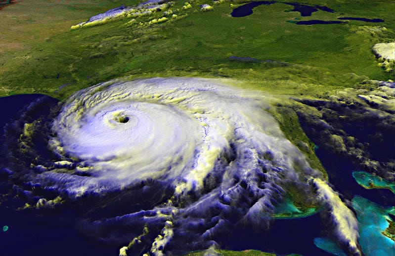
Tropical cyclones provide a perfect example of the amount of energy that can be stored in warm, moist air, and the rate at which that energy can be released. Tropical cyclones form over the ocean, where surface friction is at a minimum, and the amount of available water vapor is at a maximum. Such storms begin to lose energy as soon as they come ashore. Maximum sustained wind speeds in a tropical cyclone are 85 m/s.81 The amount of energy present in the atmosphere would be capable of wind speeds even higher than that, but the faster the winds, the lower the pressure of the inflow, and this encourages water vapor to condense before it gets to the updraft in the center of the system. The release of latent heat forms updrafts, and ultimately thunderstorms, in the feeder bands. As a result, a lot of the energy in the storm is "wasted" by turbulence in the feeder bands, and this places an upper limit on how violent the storm can become.
But mesocyclones are obviously a different breed. Despite forming over land, where the surface friction is far greater, and with less moisture, mesocyclones are capable of wind speeds over 150 m/s — roughly double that of a tropical cyclone. For some reason, the limits set by turbulence in the feeder bands do not apply to mesocyclones.
The general thinking in the meteorological community is that unlike tropical cyclones, mesocyclones feed on energy that has built up below a cap layer, and where there is a major difference in temperature and humidity between the lower and upper tropospheres. Such conditions are short-lived and relatively localized, but represent a more significant (local) potential than is present anywhere in a tropical cyclone. That much is true. But that still does not explain the moderate speeds in the flanking line.
The only reasonable explanation for the far greater speeds in a mesocyclone is that newly released energy is contributing to an existing internal recirculation. In other words, the rate of inflow and the internal rotation do not have to be directly related. The speed in a supercell's flanking line is analogous to the speed in a tropical cyclone's feeder bands, and the one scales up to the other appropriately (until the tropical cyclone's feeder bands develop their own updrafts). The actual speeds within the mesocyclone are way out of proportion to the inflowing speed in the flanking line, proving that these structures are indirectly related. This only makes sense if the mesocyclone is a sheath around the updraft that moves with it, but does not mix with it.
Predicting the direction and speed of a supercell is obviously of extreme importance, as the general public needs to be informed of the impending danger. But the movement of a supercell is surprisingly tough to predict accurately. As a result, storm-based tornado warnings have to allow for a wide margin of error. (This is masked by the trapezoidal warnings issued by NWS. More honestly, they would be triangles, starting at the mesocyclones and projecting at the angle of the margin of error.)
A rough rule of thumb is that a supercell will travel in a direction that is 30° to the right of the average mid-level winds, and at 75% the speed of those winds.82 More sophisticated algorithms have been developed for predicting storm motion given the direction and speed of the mid-level winds,83 but with only marginal improvements in accuracy.84 The loose relationship between winds and storm motion suggests that we're missing something fundamental.
Another aspect of supercells lacking a good explanation is the fact that the updrafts tends to be perfectly straight, with a 15° tilt because of wind shear.85 This is anomalous because wind speeds typically increase with altitude (see Figure 38), and therefore we would expect the updraft to curve as it ascends. When the updraft enters the jet stream, at roughly 10 km above the surface, we would expect the curvature to be dramatic. But this is not what typically happens.
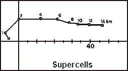
Electromagnetism offers an explanation for the straightness of the updraft, and in so doing, enables a new way of predicting storm motion that might be more accurate. Electrostatic repulsion in the charged sheath around the updraft will oppose kinks in the sheath. Since the electric force falls off with the square of the distance, the increase in electrostatic pressure on the side of the kink that is getting compressed will be far greater than the decrease on the side that expands. Hence the sheath is stable in the straight form.
Figure 40. Effects of buoyancy, wind shear, and EM on the shape of the updraft.
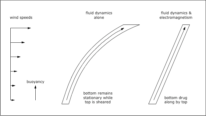
This goes on to offer an explanation for the 30° offset in the direction of the storm relative to the mid-level winds. If we take a second look at the typical wind directions and speeds, 30° to the right of the mid-level winds is typically the direction of the jet stream. By thermodynamic standards, there's no way that the jet stream could be influencing the direction of the storm, so no one looks at that, but by electromagnetic standards, this is easily possible. If the updraft has a powerful force that is keeping it straight, and if the jet stream is exerting a lateral force on the updraft at the top, then this will exert a force on the bottom of the updraft, dragging it along wherever the top is being pushed.
Analogously, if a pencil is suspended by one end under water, the pencil's buoyancy will tend to keep it pointed straight up. If the water is moving at the top of the pencil, the pencil will lean in the direction of the movement. Because of its buoyancy and because of its rigidity, the pencil will transfer the force to the bottom, and the entire pencil will move in the direction of the water, even if the prime mover is only acting on the top of the pencil.
Similarly, the updraft in a supercell is buoyant, so it would otherwise tend to be perfectly vertical. If the top of the updraft is in the jet stream, the updraft will be tilted. Because of the updraft's buoyancy and because of its rigidity, and because the jet stream is so much more powerful than the lower-level winds, the bottom of the storm will tend to follow the top, rather than the top following the bottom as we would otherwise expect.
This will be true to the extent that the mesocyclone is well-developed in the jet stream. Weaker thunderstorms, even in the same general vicinity, will tend to follow the lower-level winds. So called "left-moving" supercells (that travel in a direction that is to the left of what is expected) might then be "left-movers" simply because they are not as vertically developed as "right-moving" supercells. In other words, normal thunderstorms, and low-topped supercells, will tend to be "left-movers." Fully developed supercells will tend to be "right-movers." In the transition from a normal thunderstorm to a supercell, the storm will tend to make a right-hand turn compared to its original course.86 As the storm weakens, it will turn back to the left. All of these are well-known behaviors, though thermodynamics cannot make the connection, while the EMHD model can.
Figure 41. Strong storm follows the jet stream.
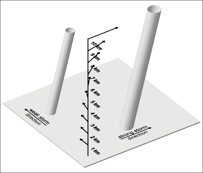
For example, during the tornado in Moore, OK, on May 3, 1999, the upper-level winds were from the southwest, while the lower-level winds were from the south. The storm tracked in a northeast direction during its most intense stages, following the upper-level winds. As it dissipated, it turned to the north, no longer controlled by the jet stream and then moving in the direction of the lower-level winds. This was true during its final dissipation stage, as well as during a brief dissipation period as it crossed the Canadian River.
Figure 42. Oklahoma City, OK
Figure 43. Upper-level winds during F5 tornado in Moore, OK, courtesy Unisys.

Figure 44. Lower-level winds during F5 tornado in Moore, OK, courtesy Unisys.

Figure 45. Moore, OK damage path, courtesy Google Maps.
(pink = F1, orange = F2, red = F3, dark red = F4, magenta = F5)
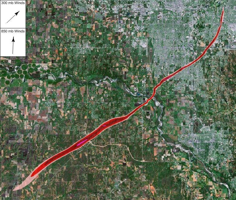
Here is similar information from the rash of tornadoes in Kansas on May 4, 2007 (one of which devastated Greensburg).
Figure 46. Greensburg, KS

Figure 47. Upper-level winds during EF5 tornado in Greensburg, KS, courtesy Unisys.

Figure 48. Lower-level winds during EF5 tornado in Greensburg, KS, courtesy Unisys.

Figure 49. The first 15 damage paths in south-central Kansas, 2007-05-04, courtesy Leslie Lemon.
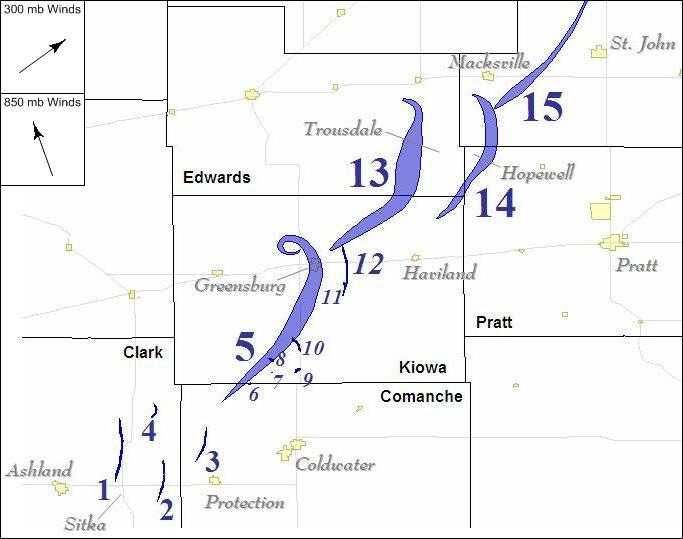
If the contentions in this section are correct, then a pre-existing knowledge of the wind speeds and directions, combined with real-time magnetometer readings to determine the amount of EM force present, and its vertical extent, would produce better short-term tornado track predictions.
Note that the curl at the end of the Greensburg damage path was due to a surge of cold air at the intersection of the warm, cold, and occluded fronts that wrapped around the storm so rapidly that it created an eddy. These will always be impossible to predict far in advance, and even predicting such behaviors minutes in advance would take an array of thermometers and anemometers within a couple of kilometers of the storm, and a team of scientists to analyze the data in real time. So unless the storm is the subject of a large field study, we'll never know when these curls are going to happen.
Figure 50. Warm, cold, and occluded fronts, courtesy University of Illinois.
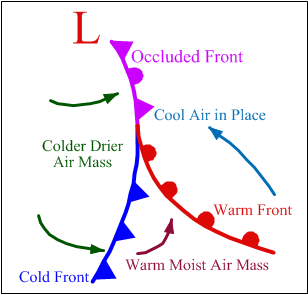
The largest hail produced by supercells can be over 100 mm in diameter. The final aggregate is a one-time consolidation of smaller hail, where the individual components are rarely more than 25 mm across.
Figure 51. Hail with 60 mm diameter, courtesy NOAA Photo Library.
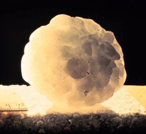
Figure 52. Largest hailstone ever recorded, 178 mm in diameter, from Aurora, NE, 2003-06-22, courtesy NOAA.
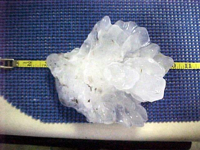
Doppler radar clearly reveals the presence of hail around the outside of the updraft. But it's hard to imagine how even small hail could have risen along with the updraft without being centrifuged out of it. With rotational speeds in the mesocyclone approaching 150 m/s, the hail would be spun out and distributed on the ground in a 360° pattern. This, of course, is not what happens — hail typically falls more or less along the inside edge of the hook echo, with the larger hail falling nearer to the mesocyclone.
Figure 53. Supercell precipitation, courtesy NWS.
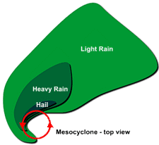
The only possible explanation for the lack of centrifugal ejection is that there is another force that is opposing it. That other force can only be electromagnetism. If the mesocyclone is a sheath around the updraft, and if the sheath has an outer, negative layer and an inner, positive layer, the electric force will keep charged particles (such as hail) within the sheath.
The only hail that does fall to the ground is not getting centrifuged outward in all directions, but rather, is falling out of the hook echo. Furthermore, larger hail falls nearer the mesocyclone, while smaller hail falls in the forward flank core. This is anomalous because the larger hail has a higher terminal velocity, and all other factors being the same, we would expect it to break out of the recirculation pattern earlier than smaller hail. Hence the stratification should be from larger hail in the forward flank core to smaller hail nearer the mesocyclone. But the larger the aggregate, the more net charge it can support. And while the terminal velocity and the momentum of the hail increase as straight-line functions of size, and so does the net charge, the effective force of the electric field increases far more rapidly, as the fundamental force is so much more powerful.
Hail-producing thunderstorms, including supercells, often have a distinctive green color.87,88,89 (See Figures 54 and 55.)
The standard explanation for this is that light is reflecting up from green vegetation on the ground, and then getting reflected back to us by the cloud.90 But this does not explain why this happens even if there isn't much vegetation in the area,87 nor does it explain such robust reflectivity in the shade of a huge thunderstorm. It also does not explain why the effect is limited to a small area, between the main rain area and the central updraft.
Figure 54. Blue-green supercell in Hagerman, NM, 2004-10-05, courtesy Steven Johnson. The patch of green vegetation responsible for the cloud's color is clearly visible in the foreground.
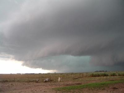
Due to the brightness of this color, another common explanation is that this is skylight that is making its way through voids in the cloud, and then getting scattered when it exits out of the bottom.91,92 But Doppler radar reveals that the main rain area is the densest region in the storm, so we should not expect any sunlight to make it through this region. Furthermore, the effect is pronounced even in the late afternoon or early evening, when the Sun is low in the sky and the intensity of the blue light in the atmosphere is waning.
Figure 55. Blue-green supercell with a tornado, wall cloud, and tail cloud, in Big Springs, NE, 2004-06-10, credit Eric Nguyen, courtesy Corbis Corporation. Click here to watch the associated video.
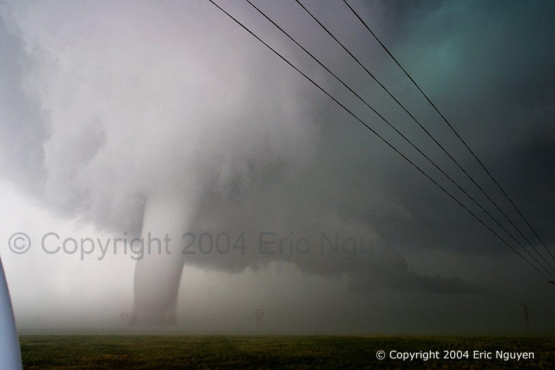
Identifying the microphysical processes responsible for a luminous color is a complex endeavor, but one sure source of photon emission is the capture of an electron by a positive ion. In order for this to be happening enough to create visible luminosity, there would have to be a lot of ions picking up free electrons. And, in fact, there is reason to believe that this is happening between the main rain area and the central updraft. Studies have shown that while the precipitation that falls to the ground originates from a region in the cloud that is predominantly negative, outside of the cloud the precipitation has a predominantly positive charge.21,93 This means that something is stripping the electrons from the falling precipitation.
There's really only one possibility here. The precipitation would have to pass through positively charged air, losing electrons in the process. This, then, constitutes one of the lines of evidence in support of the contention that there is a positive double-layer surrounding the negative charge stream. And the electron exchange accounts for the luminosity.
So we just have to look at the emission spectra for the elements abundant in the atmosphere (hydrogen, nitrogen, and oxygen), to determine which atoms are the most likely sources for this color. Both hydrogen and nitrogen have emission lines in the blue~green band. These bands dominate the actual emissions because a wider variety of atomic events can produce shorter wavelengths of photons.94
Figure 56. Emission spectra for hydrogen, nitrogen, and oxygen, courtesy Joachim Köppen.

Please note that contemplating the nature of green thunderstorms is heresy. Consider the following quote from Scientific American.95
Research on green thunderstorms is limited and not well funded. As Penn State's Craig Bohren says, this is "not exactly a hot topic of research. Indeed, being curious about them can be hazardous to one's career." For example, the small grant from the National Science Foundation for the portable spectrophotometer Frank Gallagher used was derided by then Speaker of the House Newt Gingrich's office, and by Richard Pombo, then a Republican congressman from California, who denounced Bohren in the Congressional Record.
Yet thunderstorms are natural phenomena, as worthy of study as any other, and therefore, the investigation shall proceed.
It seems that many distinctive characteristics of supercells become easier to explain when electromagnetism is taken into account. But by far the most distinctive characteristic of these storms, and the least explicable with thermodynamics alone, is tornadoes.
Tornadoes are typically thought to be simple suction vortexes responding to the low pressure under the updraft in the thunderstorm. So we should start with a review of the properties of suction vortexes.
Air responding to a low pressure tends to converge straight toward the low pressure from all directions, with kinetic energy being inversely proportional to the square of the distance from the source of the low pressure. But if, for whatever reason, the inflow was already traveling in another direction, it will split the difference between its existing momentum and the force of the low pressure, resulting in an inward spiral.
The tangential velocities in such a vortex are typically approximated with one of the Rankine formulas, which states that the velocity outside the vortex wall decreases with the inverse of the radius, asymptotically approaching zero at an infinite distance from the center.96 The inward acceleration comes from the low pressure adding a centripetal vector to the existing spiraling vector, resulting in a longer vector. Yet this increase, as the hypotenuse in a vector addition, is a lot less than the increase in velocity in a radial inflow, where the centripetal force adds a vector that is parallel to the existing motion. So in a radial inflow, velocity varies with the inverse of the square of the radius, while in a cyclonic inflow, velocity varies just with the radius.
Figure 57. Tangential vectors in a Rankine vortex, courtesy Lucas Harris and Dale Durran.

At the vortex wall, the spiraling inflow achieves a circular path around the low pressure core, and never reaches the center. While the low pressure (and thus the centripetal force) varies with the inverse of the square of distance, the centrifugal force varies with the square of the velocity over the distance, and the velocity increases with proximity to the vortex wall. When the centrifugal force becomes equal to the centripetal force, the air can move no closer to the center.
centripetal force = 1 / radius2
centrifugal force = mass × velocity2 / radius
The centripetal/centrifugal equilibrium will always be achieved at some distance from the center if there is any angular momentum at all. It may be a wide vortex, or a narrow one, but the centrifugal force will never let the air get all of the way to the center. As a consequence, the low pressure at the center goes unsatisfied, and the vortex projects away from the source of the low pressure in search of air that can satisfy it (i.e., Helmholtz's first theorem). Essentially, the low pressure gets "piped" through the vortex, with the centrifugal force creating an airtight seal that keeps the low pressure inside, and with ambient pressure just outside the vortex wall. In a fluid with no viscosity (and hence no friction to oppose the rotation), the length of the "pipe" is limited only by how far it can extend and still find air with any angular momentum at all. Practically speaking, the vortex will hit a boundary first (i.e., Helmholtz's second theorem). At the boundary, the vortex is truncated.
All real gases (such as the atmosphere) have viscosities, so we need to consider the effects of friction, which dissipates energy away from its source. From this we know that the low pressure will relax with distance from the source of the low pressure.
To understand why, let's imagine a train, where the engine pulls all of the cars, analogous to the way a low pressure pulls air. But let's imagine that the cars are connected with huge bungee cords, instead of the standard mechanical couplings. From a stopped position, when the engine is first engaged, it starts moving, which applies tensile force to the first bungee cord. This force is countered by the inertial force of the first car, so the car accelerates slower than the engine. Since its speed is less than the engine, it applies less tensile force to the car behind it than is being applied to it by the engine. And the second car applies even less to the third car. Thus during acceleration the tensile force relaxes with distance from the engine. The same is true if the "tensile force" is low pressure accelerating air, where anything that impedes the flow of air (e.g., inertia, or friction) also impedes the propagation of the low pressure back through the air.
So the friction encountered by the vortex as it rotates in the air causes the low pressure to relax with distance from the source of the low pressure. This means less centripetal force, so the vortex will expand with distance from the source of the low pressure.
In a suction vortex, there are two different relaxation regimes: one for the friction in the air itself, which is very slight, and another for the skin friction at the mouth of the vortex, which is far greater. An EF1 tornado, with a height of 350 m, a diameter of 35 m, and rotating at 45 m/s, will only lose about 1,000 watts of power due to friction in the air, but the same vortex will lose about 1,000,000 watts to skin friction at a solid boundary.97 So the friction in the air itself is almost nothing compared to the friction at the ground. As a consequence, the low pressure loses little energy as it propagates down through the main body of the vortex, producing a relatively straight "throat." But skin friction at the ground dissipates the low pressure rapidly, producing a flared radius at the bottom. Only when the inflow detaches from the boundary does it begin to feel the full force of the low pressure. Hence the spiraling inflow finally gets tightened into a circular rotation at the mouth/throat interface, well above the boundary, where the Rankine acceleration results in the fastest wind speeds.
Figure 58. Rankine vortex, with the radius of boundary detachment shown as a red dashed line.

The following images clearly illustrate the widening of a suction vortex with distance from the source of the low pressure. Note that the turbulence at the bottom is an artifact of how the smoke or steam is produced, in excess of the demand from the suction vortex. (See this for a high-resolution image of a vortex at the same location as in Figure 60.)
%208.jpg)
Figure 59. Ted Fujita's suction vortex experiment.
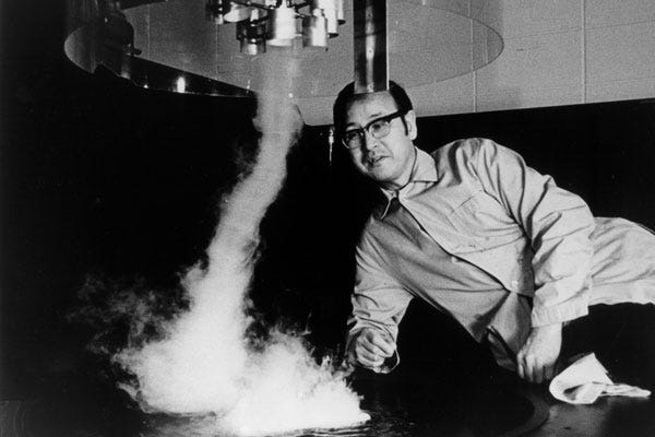
Figure 60. Suction vortex, courtesy Spiegel Online.
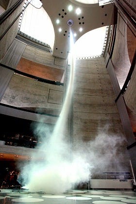
Figure 61. Suction vortex, courtesy American Educational Products.
Figure 62. Suction vortex, courtesy Holoscience.
Figure 63. Suction vortex, courtesy Ned Kahn.
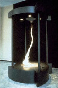
Figure 64. Suction vortex, courtesy Michael Ellestad.
Figure 65 uses smoke entering from the side of the apparatus, which makes the streamlines a bit easier to see. Notice that boundary separation occurs before the vortex has completed its final tightening into its smallest radius. Also notice that nowhere in the flow field are there any sharp corners — the air always transitions smoothly from its existing momentum into a response to a new force acting on it. So the horizontal cyclonic inflow maintains its angular momentum while the vertical velocity gradually increases in response to the low pressure at the top of the apparatus.
Figure 65. Tornado model, courtesy Instructables. Click here to watch the associated video.
Since the principles of fluid dynamics are scalable, everything in the previous section should hold true for vortexes in the atmosphere. But there is one fact that Helmholtz didn't take into account when he said that vortexes always project to a boundary. In the atmosphere, there is a density gradient that alters the aspect ratio of vortexes. In the 1 km from the cloud base down to the ground, the density of the air increases about 15%. So as the vortex spins up, and the "centrifugal seal" causes it to project downward in search of air that can satisfy the low pressure, it is projecting into heavier and heavier air. The effect of the opposing force of gravity is the same in principle as a solid boundary — the low pressure cannot be satisfied by air from underneath, so it looks laterally for new air. As a consequence, the "mouth regime" begins earlier than expected, sometimes directly at the cloud base. The flow field is sometimes visible, in the form of a wall cloud, as in Figure 66. (For extensive collections of wall cloud photography, see Sam Barricklow's page, and Roger Edward's page.)
Figure 66. Wall cloud in Kansas, courtesy WREX.
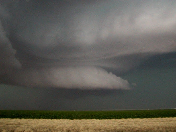
This is represented schematically in Figure 67, and computational fluid dynamic simulations confirm that this is expected behavior for a suction vortex in a density gradient.96
Figure 67. Mesocyclonic inflow, adapted from Meteorology Today by C. Donald Ahrens, © 1994 West Publishing Company, courtesy Lyndon State College.

But to whatever extent laboratory suction vortexes and in situ wall clouds make sense, tornadoes do not. Instead of the vortex converging in the direction of the flow, because of an increasing centripetal force with proximity to the source of the low pressure, a tornadic vortex diverges in the direction of the flow. This is because the lowest pressure in the vortex is at the lower boundary, as far as it can get from the source of the low pressure, generating the greatest centripetal force, and therefore the tightest radius. The vortex then expands in the direction of the flow, as the centripetal force relaxes with proximity to the source of the low pressure (which doesn't make sense). This is an apparent violation of the 2nd law of thermodynamics, and contrary to everything we know about suction vortexes. (See Figure 68.)
Figure 68. F3 tornado that has just destroyed a house larger than itself in Mulvane, KS, 2004-06-12, credit Eric Nguyen, courtesy Corbis Corporation.
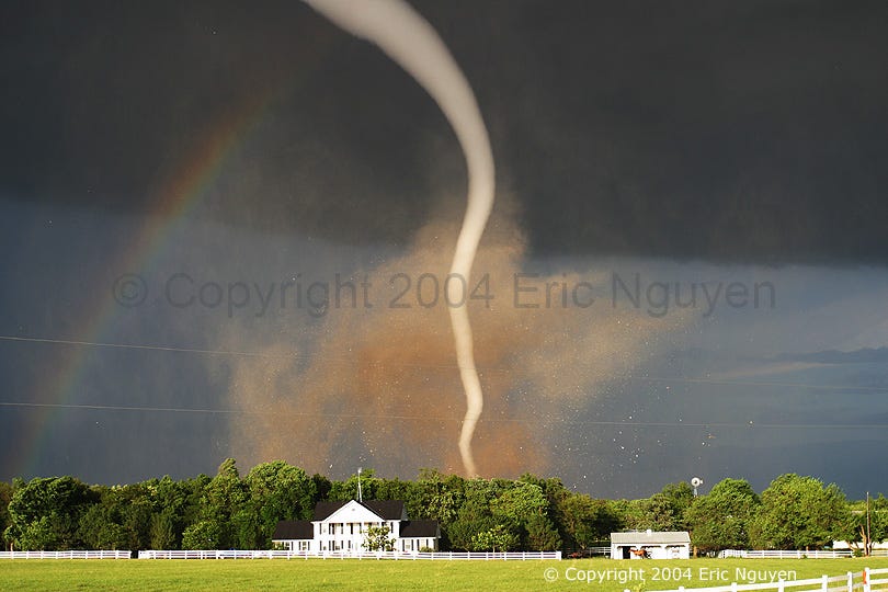
The difference here isn't just an idle curiosity. With the lowest pressure at the ground, the inflow undergoes all of the Rankine acceleration before detaching from the ground. This is the source of the tornado's destructive power. So it's not just a question of what we're missing as concerns the Second Law — it's a search for the factors that make tornadoes possible. The two most powerful mesocyclones on record didn't even spawn tornadoes, much less damage anything on the ground.98,99 That we can understand, because the density gradient combined with skin friction at the ground should generate a "mouth regime" with a very low energy density at the ground. But then weaker mesocyclones have produced EF5 tornadoes that leveled everything in their paths — without the "mouth regimes" that should have precluded such energy densities.
On further scrutiny, the differences between standard suction vortexes and tornadoes simply continue to pile up. Next we can wonder why sometimes there is a wall cloud and a tornado active the same time. (See Figures 69 and 70.)
Figure 69. Tornado under wall cloud near Anadarko, OK, 1999-05-03, courtesy NOAA.
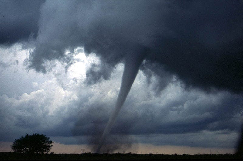
Figure 70. Tornado crossing Chesapeake Bay, 2002-04-28, credit Charlie Boyer, courtesy Calvert Cliffs Nuclear Power Plant.
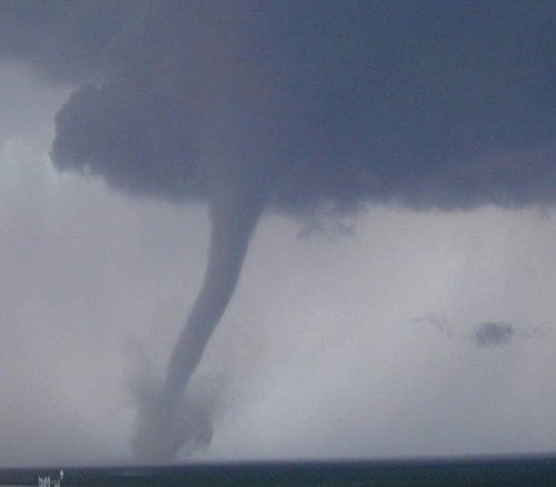
So there's a bimodal flow field,100 as already shown in Figure 67, and again in Figure 71. If the mesocyclone is the source of the energy, and if its inflow has angular momentum, a vortex will form. But how does the tornadic vortex form inside the mesocyclonic vortex? If the air is responding to the same low pressure, it will respond in the same way — air doesn't split off into a separate regime unless there is a reason. So what is that reason? In the projected mesocyclone model, there isn't any, meaning that it doesn't even acknowledge the question.
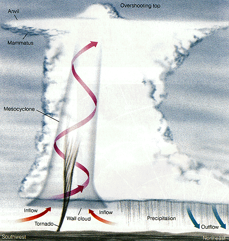
Figure 71. Airflow in a suction vortex versus a tornado vortex.

The gap between the standard model and reality widens to an impassable chasm when we consider that 20% of all tornadoes descend from thunderstorms that don't even have detectable mesocyclonic rotation.54 So the actual relationship between mesocyclones and tornadoes is indirect at best. If we are to understand tornadoes, we have to ignore any sort of vortex that may (or may not) be present inside the cloud, and study just the tornadoes themselves.
When we do, the form of the energy release is the toughest question. If the energy source was in the cloud, the energy density would relax as it projected down to the ground. Since the energy density in a tornado is greatest at the ground, and relaxes in the direction of the flow, we know that the source of the energy has to be at or near the ground.97 The 2nd law of thermodynamics is not wrong. What's wrong with the study of tornadoes as standard suction vortexes is with the assumption that they are standard suction vortexes (which would have the energy source in the direction of the flow, and which clearly is not the case in a tornado).
Some scientists believe that the near-ground energy is latent heat from the condensation of water molecules in the vortex wall (like a tropical cyclone).101 As we'll see, latent heat can provide plenty of energy, but not in the correct form. Let's assume that the ambient temperature is a sweltering 40 °C, and that the relative humidity is 100%. The lowest pressure drop ever recorded in a tornado was 100 mb below ambient.102,103 That would lower the temperature to roughly 10 °C, forcing the condensation of most of the water vapor, and the release of latent heat.
maximum water vapor content at 40 °C = 51.1 g/m3
maximum water vapor content at 10 °C = 9.4 g/m3
condensation = 51.1 − 9.4 = 41.7 g/m3
tornadic inflow (EF1) = 1,000 m3/s
total condensation = 1,000 m3/s × 41.7 g/m3 = 41,700 g/s
latent heat from condensation of water = 2,257 J/g
total latent heat = 41,700 g/s × 2,257 J/g = 94,117,000 J/s
watt = joule / second
power = 94,117,000 W
With that much heat being released into that much air, we can then calculate the temperature increase, given that raising the temperature of 1 m3 of air by 1 °C in 1 second requires approximately 1,340 watts.
watts per cubic meter = 94,117,000 W / 1,000 m3/s = 94,117 W·m3·s
temperature difference = 94,117 W·m3·s / 1,340 W·°C·m3·s = 70.24 °C
Knowing the temperature difference, we can then find the pressure at which a parcel of air at such a temperature will achieve equilibrium in the atmosphere. In other words, the temperature increase will cause the gas to expand, which will reduce its density, giving it the buoyancy necessary to rise, until it reaches the altitude at which that's the normal pressure. The easiest way to find this pressure is to simply find the ratio of the temperatures before and after such heat was applied, and to multiply the standard atmospheric pressure by that ratio.
temperature = standard + difference = 15 °C + 70.24 °C = 85.24 °C = 358.39 K
temperature ratio = standard / resultant = 288.15 K / 358.39 K = 0.804
resultant pressure = standard × ratio = 1013.25 mb × 0.804 = 814.67 mb
Knowing the pressure, we can then find the altitude. We could do this with the ideal gas laws, or we could just use a convenient algorithm that works just for the troposphere. Note that this assumes a standard atmosphere (i.e., without the transient temperature and pressure gradients normally associated with thunderstorms), but we don't need to know the exact altitude — we just want to get an idea of how buoyant the air will be, and the height through which the energy conversion will occur.
altitude = 44307.694 × (1 − (millibars / 1013.25) 0.190284) = 1.8 km
1.8 km is roughly twice the height of a typical tornado, so we clearly have enough thermal energy for a robust updraft within the tornado.
But this won't explain the extreme low pressure at the base of the tornado. The reason is that the release of latent heat is a gradual process, and there is no way to get all of the energy released all at once at the ground level. When water molecules condense, they release heat into the surrounding air. This halts the release of latent heat, as the hotter, drier air is now well above its dew point. The hotter air expands, which makes it less dense, which gives it the buoyancy necessary to rise. This carries it up to an altitude where there is less pressure, which allows it to expand even more, which lowers the temperature. Then the air hits its dew point again, and more water vapor condenses, releasing more latent heat. But without the effects of the pressure gradient in the atmosphere, condensation is a self-extinguishing process. Hence a flow field motivated by latent heat simply mimics air responding to an even lower pressure aloft, and the original question concerning the extreme low pressure near the ground is left unanswered.
As conventional meteorology offers no other conversion that could be occurring that close to the ground, and which could release that much energy, the only other possibility is that the conversion involves the only other force present, which is electromagnetism.